| Hills of Canton, Mass. |
| | Hills | More about Canton's USGS-listed hills | Maps | Sources | |
| Great Blue Hill |
|
| Green Hill |
| • |
Google Maps | Google Earth - Google |
| • |
The Green Hill Papers: Part One (PDF), "...The Green Hill site was occupied chiefly during the Middle and Late Archaic periods...Quite possibly the hill has been little disturbed by human activity since prehistoric times...", Bulletin of the Massachusetts Historical Society, Vol. 41, No. 1, April 1980 - Maxwell Library, Bridgewater State University |
| • |
A Lithic Journey, 2014 - A Postcard from Canton |
| • |
Green Hill Site, "...The Green Hill Site is a prehistoric archaeological site in Canton, Massachusetts. It is located near the Neponset River, extending upland for a distance of about 500 feet up to the crest of Green Hill, an elevation of about 110 feet...The site encompasses a Middle to Late Archaic period encampment, where Neville style projectile points, gouges for woodworking, and a stone-working worksite have been found..." - Wikipedia |
|
| Little Blue Hill |
|
|
|
|
|
| More about Canton's USGS-listed hills |
|
Canton officially became a town in 1797 after splitting off from Stoughton, which itself had separated from colonial Dorchester in 1726. The naming of the new town was unusual. Typically, the town with the important First Parish Church kept the original name, and the town with the Second Parish Church had to come up with a new name. In the case of Canton, it had the First Parish Church, but decided to change its name. Daniel T.V. Huntoon, in his 1893 definitive history of Canton, denies that the name of the town was based “on account of the China Trade.” Saying instead that the naming of the town was based on the whim of a prominent citizen, Elijah Dunbar, who mistakenly thought the town was directly antipodal to Canton (now Guangzhou) in China. It’s not even close, the antipodal location of Canton, Mass. is well into the Indian Ocean off Australia.1 |
| Elijah Dunbar was a well-educated man. A Harvard graduate, a mathematician and surveyor, he founded the first library in the town with his own books.2 It seems unlikely he would be unaware that Guangzhou (Canton) was north of the equator so couldn’t possibly be antipodal to Canton, Mass. On the other hand, Canton had just opened its port for trading in 1785, and in 1787, the Astrea had arrived in Salem, Mass. harbor, the first New England ship to trade directly with China.3 In post-Revolutionary War New England, it’s likely that Canton, and trade with China was of great interest.4 |
| Only Canton's USGS-listed Little Blue Hill (315 ft.) is within Boston Basin Hills survey area. It is the western-most hill in the Blue Hills Reservation. |
|
|
| Canton Maps |
| • |
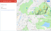
Canton - Google Maps, Terrain |
| • |
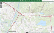
Canton - MassMapper MassGIS |
| • |
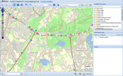
Canton - USGS - The National Map |
| • |
Norwood Quadrangle - 2018 (60 MB PDF) - USGS Topo Download |
| • |
Blue Hills Quadrangle - 2018 (60 MB PDF) - USGS Topo Download |
| • |
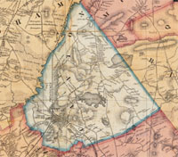
Map of Norfolk County, Massachusetts, Henry F. Walling, 1853 - Library of Congress |
| • |
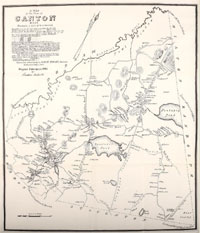
Map of Norfolk County, Massachusetts, Smith & Bumstead, 1858 - Library of Congress |
| • |
Canton Maps - Canton Historical Socirty |
| • |
Blue Hills Reservation Trail Map (PDF) - State of Massachusetts |
| • |
Blue Hills Reservation; Massachusetts, E.G. Chamberlain,1885 - Olmstead Archives, NHS, NPS |
| • |
Historic Writing and Maps - Friends of the Blue Hills |
|
|
| Canton Sources |
| • |
History of the Town of Canton, Norfolk County, Mass., Daniel T.V. Huntoon, 1893 (republished 1975) - Internet Archive |
| • |
A History Of The Town Of Canton, Massachusetts, Part 1, Part 2, Canton Bicentennial Historical Committee, 1997 - Canton Historical Society |
| • |
Canton, 1797-1947, Gerald F. Burke, 1947 - Internet Archive |
| • |
Canton: Images of America , R. Marc Kantrowitz, 2000 - Google ebook preview |
| • |
Canton: Postcard History Series, George T. Comeau, 2009 - Google ebook preview |
| • |
Canton Historical Society |
| • |
Canton Historical Society Wiki |
|
|
|
|