| Hills of Hull, Mass. |
| | Hills | More about Hull's USGS-listed hills | Maps | Sources | |
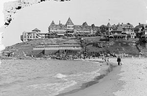
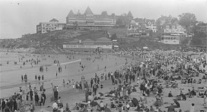
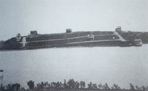
| Allerton Hill |
| • |
USGS identified - MassMapper MassGIS |
| • |
Google Maps | Google Earth - Google |
| • |
"...In September, 1621, a party of ten, including Isaac Allerton, went by water to explore what is now the harbor of Boston, and to visit the Indians who lived in that vicinity, and on this trip the first headland at Nantasket, at the entrance to the harbor was called Point Allerton, a name which it still retains, although it has sometimes been spelled Alderton; an adjoining hill in the town of Hull was also known for many years as Allerton Hill...", A History of the Allerton Family in the United States, pg. 18, Walter S. Allerton, 1900 - Internet Archive |
| • |
"...and the drumlin known as Allerton Great Hill on the north...", Johnson, Reed. pg. 163, 1910 - Internet Archive |
| • |
"...Great Hill, at Allerton, has a strongly marked cliff on the eastern end where the waves are still cutting into the hill, although
not so effectively as formerly...", Johnson, Reed. pg. 169, 1910 - Internet Archive |
| • |
Allerton Hill - USGS Geographic Names Information System
Variant name: Great Hill |
|
| Atlantic Hill |
|
| Center Hill |
|
| Gallops Hill |
| • |
Google Maps | Google Earth - Google |
| • |
"...Along Spring Street, just past the site of the Hull Cemetery, several homes are situated on Gallops Hill, overlooking Hull Bay...",, Hull Preservation Committee, pg. 15, 1999 - internet Archive |
| • |
Gallup, "...John Gallup was born in England in 1590. He sailed from Plymouth England March 20, 1630 in the ship 'Mary and John' arriving at Nantasket, May 30 following...He was a skillful mariner, well acquainted with the harbor around Boston, and in the habit of making frequent trading expeditions along the coast in his own vessels...", New England Families, Genealogical and Memorial, Vol. 3, pg. 1088, William R. Cutter, 1913 - Google ebook |
|
| Green Hill |
| • |
USGS identified - MassMapper MassGIS |
| • |
Google Maps | Google Earth - Google |
| • |
H.D. Delano House, "...When the Proprietors of Hullwere established in 1657, the southern section of Hull, which includes Green Hill was considered the Further Hills and was aid out as common land. Being less desirable for grazing due to its great distance from the Village, the land was leased for 999 years to a group whorelinquished title to other common lands in exchange. Green Hill was in the leased property. As saltworks was established and the remainder of the land devoted to farming until the early stirrings of a resort community began to change the area in the 1840's...."- Massachusetts Historical Commission Information System (MACRIS) |
| • |
"...Among the first homes that of Israel Nichols the weaver, on the south side of Straits Pond, where Jerusalem Road now runs, ought to be recounted...How long since his dwelling house had been in Cohasset no one can tell, but it had been built upon Green Hill sixteen years before, and at some winter between these two dates, 1679 and 1695, it had been sledded across the
ice on Straits Pond...", A Narrative History of the Town of Cohasset, Massachusetts, pg. 172 , E. Victor Bigelow, 1956 - Internet Archive |
| • |
"...It is said that decoy lights were even put up at Green Hill north of Straits Pond, for the villainous purpose of imitating Boston Light in order to bring vessels upon the Cohasset rocks....", A Narrative History of the Town of Cohasset, Massachusetts, pg. 319, E. Victor Bigelow, 1956 - Internet Archive |
| • |
Green Hill - USGS Geographic Names Information System |
|
| Gun Rock |
|
| Hampton Hill |
|
| Hull Hill |
| • |
Google Maps | Google Earth - Google |
| • |
Hull Hill - Massachusetts Cultural Resource Information System (MACRIS) |
| • |
"...Standing on Hull Hill and looking north...",, Hull Preservation Committee, pg. 10, 1999 - internet Archive |
| • |
Hull Hill, "...The land on Hull Hill was divided into home lots for the Proprietors of Hull in 1657. The configuration of these lots was to remain virtually intactuntil the 1870's when descendants of the original families began selling off the grazing land to several developers from Hull and Hingham..."- Massachusetts Historical Commission Information System (MACRIS) |
| • |
"...Thornbush Hill, just west of Nantasket Hill, is somewhat more strongly cliffed, but retains its initial form to a marked degree...", Johnson, Reed. pg. 169, 1910 - Internet Archive |
|
| Little Hill |
| • |
Google Maps | Google Earth - Google |
| • |
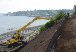
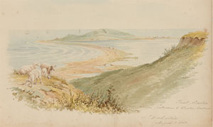
"...Little Hill at Allerton is of special interest because it is evidently but a small remnant of a drumlin on the northeast of Great Hill. It would doubtless have been completely removed by the waves ere this but for the protection afforded by a stone sea-wall constructed north and east of it to prevent its complete destruction...", Johnson, Reed. pg. 170, 1910 - Internet Archive |
|
| Long Beach Rock |
|
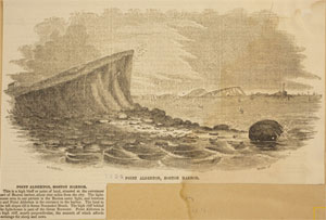
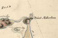
| Point Allerton |
| • |
USGS identified - MassMapper MassGIS |
| • |
Google Maps | Google Earth - Google |
| • |
"...In answer to your favour of yesterday I must inform you, that I have often been told of the advantages of Point Alderton with respect to its command of the shipping going in and out of Boston Harbour...
Foonote:
Point Alderton (now Allerton), located at the end of Nantasket peninsula, overlooks Nantasket Roads, the main ship channel leading into Boston Harbor. Point Alderton lies on the south side of the channel, and Lighthouse Island is on the north side...", Letter from George Washington to Joseph Palmer, 22 August 1775, Founders Online - National Archives |
| • |
Point Allerton (Cape) - USGS Geographic Names Information System
Variant name: Point Aldertown |
|
| Quarter Ledge |
|
| Rockland Hill |
| • |
Google Maps | Google Earth - Google |
| • |
"...Rockland Hill, however, is only an incipient drumlin, and might be more properly classed as a lenticular slope of till...", Crosby. pg. 140, 1900 - Internet Archive |
|
| Sagamore Hill |
| • |
USGS identified - MassMapper MassGIS |
| • |
Google Maps | Google Earth - Google |
| • |
"...Sagamore Hill was probably the residence of some Indian sachem...", Homer, pg. 26, 1848 - HathiTrust |
| • |
"...Sagamore Head, near Hampton Hill, preserves a nearly perfect outline except for a pronounced cliff on the the northeast side and
a minor cliff on the north and west...", Johnson, Reed. pg. 169, 1910 - Internet Archive |
| • |
Sagamore Hill - USGS Geographic Names Information System
Variant name: Sagamore Head |
|
| Skull Head |
| • |
Google Maps | Google Earth - Google |
| • |
"...Skull Head represents the final stage in the series, having been completely destroyed. This drumlin was situated to the northwest of Strawberry Hill, and so far as we can tell was probably of small size. It was apparently nearly destroyed by wave action from the west, the last remnant being removed by man and used as road material...", Johnson, Reed. pg. 170, 1910 - Internet Archive |
| • |
"...Skull Head was so named, tradition says, in commemoration of a great Indian battle, fought between the natives of the North and South Shores, and the bones of the killed were to be seen there at the settlement of the country...", Lincoln. pg. 15, 1830 - HathiTrust |
|
| Strawberry Hill |
| • |
USGS identified - OMassMapper MassGIS |
| • |
Google Maps | Google Earth - Google |
| • |
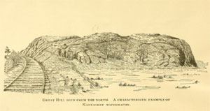
"...Strawberry Hill, about half-way between Allerton and Sagamore Head, is in many respects the most remarkable drumlin in the district...", Johnson, Reed. pg. 169, 1910 - Internet Archive |
| • |
"...Strawberry Hill, takes its name from the abundance of the delicious berry of that name, formerly found there...", Lincoln. pg. 14, 1830 - HathiTrust |
| • |
Strawberry Hill - USGS Geographic Names Information System |
|
| Sunset Point |
|
| Telegraph Hill |
| • |
USGS identified - MassMapper MassGIS |
| • |
Google Maps | Google Earth - Google |
| • |
Telegraph Hill, "...The site was first used as a fort in 1776 to defend the port of Boston. The first telegraph tower was built in 1827. Several other telegraph stations later occupied the site until 1938, when radio communications made the site obsolete..." - Wikipedia |
| • |
Fort Revere, "...Telegraph Hill, the site of Fort Revere, was first fortified by Patriot forces in 1776 during the American Revolution and called Fort Independence...." - Wikipedia |
| • |
"...Nantasket Hill at Hull, also called Telegraph Hill, is another drumlin which has suffered but little erosion; it is slightly cliffed on the south...", Johnson, Reed. pg. 169, 1910 - Internet Archive |
| • |
"...The drumlin now knows as Telegraph Hill possoble got its name as early as 1827 when John Rowe Parker extended te inner harbor's telegraph station to its apex...",, Hull Preservation Committee, pg. 21, 1999 - internet Archive |
| • |
Telegraph Hill - Massachusetts Cultural Resource Information System (MACRIS) |
| • |
Telegraph Hill - USGS Geographic Names Information System
Variant name: Nantasket Hill |
|
| White Head |
| • |
USGS identified - MassMapper MassGIS |
| • |
Google Maps | Google Earth - Google |
| • |
"...North of Sagamore Head is White Head, a drumlin which retains its initial form fairly well on the south, although a slight cliffing is noticeable there; but which has a remarkable strongly curved cliff cut into its northern side, and smaller cliffs on the northeast and east...", Johnson, Reed. pg. 169, 1910 - Internet Archive |
| • |
White Head - USGS Geographic Names Information System |
|
| Windmill Point |
| • |
USGS identified (Cape) - MassMapper MassGIS |
| • |
Google Maps | Google Earth - Google |
| • |
"...One such windmill and perhaps others were erected in Hull during the late 18th and 19th centuries. In fact, the northernmost tip of Hull was named Windmill Point for that very reason...", An Analysis of Wind Power Development in the Town of Hull, MA, pg. 5 (PDF), R. Christopher Adams, Hull Municipal Light Plant, 2013
- U.S. Department of Energy |
| • |
Pemberton Point, "...Pemberton Point (formerly known as Windmill Point) is a peninsula in Hull, Massachusetts. It is located at the tip of the Nantasket Peninsula, in Boston Harbor...." - Wikipedia |
| • |
Windmill Point (Cape) - USGS Geographic Names Information System |
|
|
|
 |
|
 |
|
 |
|
 |
|
 |
|
| Allerton Hill |
 |
|
|
|
 |
|
| Atlantic Hill |
 |
|
 |
|
 |
|
| Center Hill |
 |
|
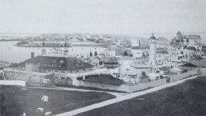
| Green Hill |
 |
|
| Point Allerton |
 |
|
 |
|
 |
|
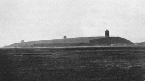
| Sagamore Hill |
 |
|
 |
|
| Strawberry Hill |
 |
|
|
|
| More about Hull's USGS-listed hills |
|
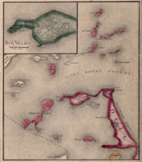
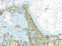
Located at the entrance to Boston Harbor, Hull has seen visitors from a very early date. In 1621, nine years before John Winthrop and the Puritans arrived, a party from the recently established Plymouth Colony ventured north into what was then not yet called Boston Harbor. The peninsula they first crossed by was known as Nantascot, from the Native American word for "at the strait", "low-tide place", or "where tides meet." Initially consisting of a trading post and a seasonal fishing station, Nantascot was designated as a plantation, a sort of pre-town, in 1641. In 1643, the town of Hingham attempted to claim the area, but were rejected by the court. In 1644, the area was incorporated as a town, and its name changed to Hull, most likely for the city in England. Though an interesting argument from the early 1900s speculates that the name may refer to the nautical expression, “to lie a hull.”1 Hull, Nahant and Winthrop are the three towns in the Boston Basin that have, in addition USGS topographic maps, NOAA nautical charts that identify geographic and other features for their whole land area. All three are also peninsulas so have hill-like features the USGS identifies as Capes and Islands. Hull has eight USGS-listed Summits; Allerton Hill (115 ft.), Atlantic Hill (85 ft.), Center Hill (79 ft.), Green Hill (43 ft.), Hampton Hill (30 ft.), Sagamore Hill (85 ft.), Strawberry Hill (102 ft.), and Telegraph Hill (121 ft.). |
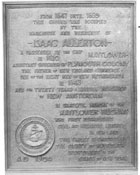
| The USGS lists Allerton Hill as a Summit, and nearby Point Allerton as a Cape, with an elevation of 23 ft. NOAA only identifies Point Allerton. They are named for Isaac Allerton (also spelled Alderton). He and his family had been passengers on the Mayflower in 1620, and was the fifth signature on the Mayflower Compact, He served as an assistant to Governor William Bradford and was given the honor of being addressed as “Mister”, Allerton married the daughter of senior elder William Brewster and he was on the boat that sailed into Boston Harbor in 1621. |
| But Isaac Allerton was not a typical Pilgrim Father.2 He would be banished from Plymouth in 1630, his distractors accusing him of betraying “the colony's trust by overcharging, mishandling the colony's finances and increasing the colony's debt without approval.” He left and started trading stations on the Kennebec and Penobscot Rivers. In 1632, he established a fishing enterprise in Marblehead and along with Moses Maverick, brother of early Massachusetts colonist Samuel Maverick, is a considered a founder of the town. In 1635, Allerton was banished again, this time for befriending religious separatist Roger Williams, and bringing back to New England, previously banished colonist Thomas Morton. Allerton then settled in New Haven, Conn. |
|
Allerton’s supporters paint a picture of him as an 18th-century man decades ahead of his time. His early negotiations in London for the Pilgrims are considered by some as the first leveraged buyout in America, and ensured that the colonists, while being burdened the debt, would have title to the land. This was a break from the landed gentry and servant traditions of Europe, and while it wasn’t the communal ownership the religious leaders had hoped for, it was a realistic model that would ensure prosperity in New England. Allerton is also called by some as the "Father of New Commerce." After getting banished from Marblehead and moving to New Haven, Conn., Allerton started working with the Dutch in New Amsterdam (New York City) building a warehouse trading in tobacco. Along with the Dutch, he would eventually trade with the Native Americans, the English, the Swedes, the French, and the Spanish. His mercantile connections stretched from the rivers of Maine to the West Indies, and to Europe. The New England that became a trade and mercantilepowerhouse in the future would owe much to Isaac Allerton. |
| The three USGS-listed hills on the mainland portion of Hull are, Atlantic Hill, Center Hill, and Green Hill. Atlantic Hill is first identified on a USGS topographic map in 1936. NOAA dating back to 1857 identify an Atlantic House on the hill. The first building on the site was constructed in 1845, greatly expanded in 1877, and burned to the ground in 1927, NOAA charts change their labelling from Atlantic House to Atlantic Hill in 1941. Center Hill is also first identified by the USGS in 1936. It doesn’t appear on NOAA charts until 1948. Green Hill appears on both earliest USGS and NOAA maps, and there is a record of one the settlers in the area, Israel Nichols, moving a house from Green Hill to Cohasset on ice in the mid-1600s. It is not known if Israel referred to the hill as Green Hill. |
| The three USGS-listed off the beach are, Hampton Hill, Sagamore Hill, and Strawberry Hill. It is unknown how Hampton Hill got its name. Sagamore Hill is the name of several hill in the Boston Basin. Sagamore, from the Algonquian language, is a term used to describe the rank of tribal leader or chief. Likely it was named by early the settlers for the place where they would have met with Native Americans, and the Sagamore. Logically, Strawberry Hill, takes its name from the abundance of the berry of that name, formerly found there. |
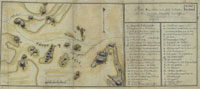
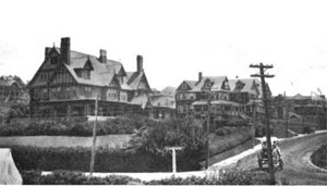
| As the name implies, Telegraph Hill, in Hull Village near the end of the peninsula, was the location of a telegraph tower, the first built in 1827. It also the location of Fort Revere first fortified by Patriot forces in 1776 during the American Revolution and, at that time, called Fort Independence. |
|
|
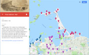
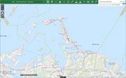
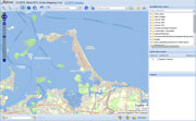
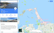
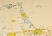
| Hull Maps |
| • |
Hull - Google Maps, Terrain |
| • |
Hull - MassMapper MassGIS |
| • |
Hull - USGS - The National Map |
| • |
Hull Quadrangle - 2018 (60 MB PDF) - USGS Topo Download |
| • |
Nantasket Quadrangle -: 2018 (60 MB PDF) - USGS Topo Download |
| • |
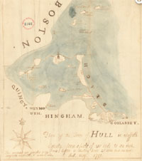
Hull Maps: 41, 42, 43, Atlas of Plymouth County, Geo. W. Walker & Co., 1879 - State Library of Massachusetts |
| • |
Hull maps, 19, 20, 21, Atlas of Plymouth County, L.J. Richards & Co., 1903 - State Library of Massachusetts |
|
|
| Hull Sources |
| • |
Sketch of Nantasket: (now called Hull,) in the county of Plymouth, Solomon Lincoln, 1830 - HathiTrust |
| • |
Notes on the Sea-Shore; Or Random Sketches, In Relation to the Ancient Town of Hull, James L. Homer, 1848 - HathiTrust |
| • |
The Form of Nantasket Beach, Douglas W. Johnson, William G. Reed, 1910 - Internet Archice |
| • |
At the Gateway of Boston Harbor, New England Magazine, Vol. 42, pg. 693, Chas. M. Rockwood, 1910 - Google ebook |
| • |
Hull and Nantasket Beach, Images of America, Committee for the Preservation of Hull's History, 1999 - Internet Archive |
| • |
Hull and Nantasket Beach, Then & Now, Committee for the Preservation of Hull's History, John Galluzzo, 2001 - Google ebook preview |
| • |
Hull, History of Plymouth County, Massachusetts, with Biographical Sketches of Many of its Pioneers and Prominent Men, Duane Hurd, 1884 - Internet Archive |
| • |
Kings Handbook of Boston Harbor, Moses F. Sweetser, 1888 - HathiTrust |
| • |
Tourists' Guide, Down the Harbor, Hull and Nantasket, 1897 - Google ebook |
| • |
A Pleasure Guide to Nantasket Beach, and Boston Harbor, Charles H. Fringham, 1884 - HathiTrust |
| • |
Geology of the Boston Basin, Pt. 1, Nantasket and Cohasset, William O. Crosby, 1900 - Internet Archive |
| • |
Hull, MHC Reconnaissance Survey Town Report (PDF), 1979 - Massachusetts Historical Commission |
|
|
| Footnotes |
| 1 |
The Naming of Hull, Massachusetts, The New England Historical and Genealogical Register, Vol. 59, pg. 177, Albert Mathews, 1905 - Google ebook |
| 2 |
The Allerton Family, pg. 596, Descendants of Edward Small of New England, Laura A.W. Underhill, 1910 - Internet Archive |
| |
History of The Anicent Maritime Interests of New Haven, Vol. 3, pg. 101, Thomas R. Trowbridge, Jr., Papers of the New Haven Colony Historical Society, 1882 - Internet Archive |
|
Allerton Family, Americana, Vol. 15, pg. 91, 1921 - Google ebooks |
|
Pilgrims in the Atlantic World: Atlantic influences and the New Plymouth colony's commercial impact on New England, John D. Furlow, 2009 - Vanderbuilt Discover Archive |
|
Reflections on Isaac Allerton, Robert J. Heinsohn - Sail1620 |
|
Isaac Allerton: Saint, Sinner, Entrepreneur, John M. Hunt, Jr. - Sail1620 |
|
Isaac Allerton and Tobacco: Give Him a Pinch, He'll Sell You a Ton, John M. Hunt, Jr. - Sail1620 |
|
Bradford's History of 'Plimoth Plantation', William Bradford, 1898 - Project Gutenberg |
|
Isaac Allerton - MayflowerHistory.com |
|
Isaac Allerton - Kristin C. Hall |
|
Isaac Allerton, "Mayflower" Passenger - Geni.com |
|
|