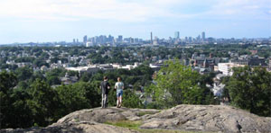
| Hills of Malden, Mass. |
| | Hills | More about Malden's USGS-listed hills | Maps | Sources | |
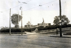
| Baileys Hill |
| • |
"...On the highland, since known as Bailey's Hill, John Lewis had settled on his five-acre lot 'in ye common field,' and given his name to the bridge at its foot, which it retained until within a few years, when the brook lost its ancient character and the passage beneath the street became a culvert....", Corey, pg. 102, 1899 - Internet Archive |
| • |
"... It stood on the southerly slope of Bailey's hill, perhaps a little to the westward of Bell Rock....", Register of the Malden Historical Society, No. 1-4, pg. 22 , 1910-1916 - Hathitrust |
|
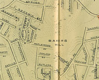
| Bakers Hill |
|
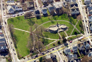
| Bell Rock |
|
| Belmont Hill |
|
| Boojum Rock |
|
| Dickermans Hill |
| • |
"...Thomas Dickerman had settled towards the Boston line, where Dickerman's Hill in the easterly portion of Salem Street still preserves his memory; and the town confirmed his heirs in the possession of the house which he built with land around it...", Corey, pg. 364, 1899 - Internet Archive |
|
| Faulkners Hill |
| • |
Google Maps | Google Earth - Google |
| • |
"...Faulkner, David, Jr., was in garrison at Dedham in July, 1676, with his father, David, Sen. They had, probably, gone from Boston, but they were credited to Dedham in the settlement of August, 1676. The younger man afterwards came to that part of Maiden or Boston near Black Ann's Corner, and was the ancestor of the Faulkner family here....", Corey, pg. 324, 1899 - Internet Archive |
|
| Gardners Hill |
| • |
"... Near Gardner's Hill it turned to the right over a wide and rocky way and ended for the nonce at a stone wall and a pair of bars, beyond
which was a clearing in the woods known as Barnes's Garden....", Register of the Malden Historical Society, No. 5-6, pg. 9, 1918-1920 - Hathitrust |
|
| Grandfathers Hill |
|
| Great Hill |
|
| Greens Hill |
| • |
Google Maps | Google Earth - Google |
| • |
"...Not far from Lewis, in the vicinity of Bell Rock or farther south, beyond the meadow, on Green's Hill, was William Brackenbury, a prominent man, who is supposed to have been one of the earliest to plant on the banks of the North River...
...Farther east on Green's Hill, James Green had built on the Graves lot the house of which a portion, as has been mentioned, is still standing on Appleton Street...", Corey, pg. 102, 1899 - Internet Archive |
|
| High Rock |
|
| High Rock II |
|
| Island Hill |
| • |
Google Maps | Google Earth - Google |
| • |
"...Island end must not be confounded with Island Hill, a rocky hill on the west side of Main Street, between Forest Street and Pine Banks
Park, which in early days was surrounded by the meadows of Three Mile Brook...", Corey, pg. 56, 1899 - Internet Archive |
|
| Linden Highlands |
|
| MIT Geodetic Observatory |
|
| Pinnacle Rock |
|
| Quarry Hill |
|
| Schoolhouse Hill |
|
| Seven Bumps |
| • |
Google Maps | Google Earth - Google |
| • |
Seven Bumps, "... Seven Bumps is a hill located in the West End section of Malden Massachusetts. It is located off Fellsway East, behind Fellsmere Pond. This hill has been used for decades in the wintertime for sledding and snowboarding...It is believed that the sport of mountainboarding originated here...." - Wikipedia |
|
| Spragues Ledge |
|
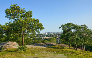
| Waitts Mountain |
| • |
USGS identified - MassMapper MassGIS |
| • |
Google Maps | Google Earth - Google |
| • |
Waitt's Mountain - Wikipedia |
| • |
"...Winding around the northern and western base of Wayte's Mount, known to the first settlers as Mount Prospect...", Corey, pg. 20, 1899 - Internet Archive |
| • |
A Transformed Waitt's Mount Popular with the Public, "...In 1638, John Wayte, for whom Waitt's Mount was named, arrived from England and settled on nearby Mountain Avenue. Wayte was the son-in-law of Joseph Hills, who named Malden after his hometown of Mauldon, England.... " - Malden Redevelopment Authority |
| • |
Waitts Mount Park, "...Waitts Mount is named after Cpt. John Wayte, an early English 17th century landowner, also called Mount Prospect and Captains Hill in Maiden records of 1640.... " - Massachusetts Historical Commission Information System (MACRIS) |
| • |
"...John Waite born about 1618; accompanied, or followed, to New England, his father-in-law, Joseph Hills, who came in the "Susan and Ellen," of London, in 1638; was one of the early settlers at Mystic Side (afterwards Maiden), where
he purchased a house and land of widow Martha Coytemore in 1644...", The Waite Family of Malden, Mass., Deloraine P. Corey, pg. 15, 1913 - Internet Archive |
| • |
Waitts Mountain - USGS Geographic Names Information System |
|
| Windy Hill |
|
|
|
 |
|
 |
|
Middlesex Fells
Reservation |
 |
|
| Bakers Hill |
 |
|
| Bell Rock Hill |
 |
|
 |
|
| Grandfathers Hill |
 |
|
| Waitts Mountain |
 |
|
 |
|
| |
|
|
| More about Malden's USGS-listed hills |
|
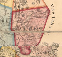
The area now named Malden was originally called the "Mistick Side" and was a part of Charlestown. It was incorporated as a separate town in 1649. The city originally included what are now the adjacent cities of Melrose (until 1850) and Everett (until 1870). Malden has four USGS-listed hills, Belmont Hill (69 ft.), Boojum Rock (279 ft.), High Rock (112 ft.), and Waitts Mountain (213 ft.) While Belmont Hill is a USGS-listed hill, with its summit not far from Malden center, the hill does not appear on USGS topographic maps. Belmont Hill is also the name given to a hill not listed by the USGS in nearby Everett, Mass. (formerly the South Precinct of Malden). That hill in Everett is much taller with an elevation of a little over 130 ft. The citation for the USGS-GNIS record for Belmont Hill in Malden is a 1965 book by historian Alden T. Vaughan and not a U.S. Geological Survey, as it is with almost every other hill in the Boston Basin survey. The 1856 H.F. Walling map for Middlesex County, with what will be Everett identified as South Malden, shows a highland extending from almost Malden center, one mile south east to just past Broadway in today’s Everett. Possibly it’s the same hill. Belmont is a commonly used name derived from the French "beu", fair, lovely, with "mont", a hill. |
| High Rock is another USGS-listed hill with only Alden T. Vaughan noted in the citation. Making maters more confusing is another nearby hill Malden identified as High Rock in town documents. |
| Boojum Rock is probably the most whimsical name of any hill in the Boston Basin. George E. Davenport, in his 1893 “A Lecture on the Middlesex Fells”, doesn’t directly cite the character in Lewis Carroll’s 1876, The Hunting of the Snark, but his description of something that “suddenly disappears from view, and then as suddenly re-appears, without any apparent reason”, is clearly a reference to the Boojum in the poem. |
| John Waite (1618-1693)1 immigrated to New England in 1638 with his first wife Mary (Hills) (1625-1674) as part of the family of his father-in-law, Joseph Hills (1602-1688). After first settling in Charlestown, they soon moved to a farm at Mystic Side (Malden). Joseph Hills,2 one of the few lawyers in the colony, became deputy to the general court, and speaker of the house of deputies in 1647. Malden is named for his hometown of Maldon in England. John purchased a house and land on the hill from Martha Coytmore (Rainsborough) (1617-1660) in 1644. She was the widow of Thomas Coytmore (1612-1647).3 He had immigrated with her in 1636 first again to Charlestown, then to Mystic Side, where he built a corn mill. He was also a sea captain, and sailed the first large ship made in Boston, the Trial, on a successful trading mission. He died at sea in a shipwreck in 1647.4 After his death, she married Governor John Winthrop (1587-1649) in 1647, he was 59, she was 30. Winthrop died two years later. Martha married wealthy merchant John Coggan (1591-1658) in 1652. When he died six years later she was 41 years old, widowed for a third time, and have all her six children were dead. Stricken with grief, and unable to find a suitable fourth spouse, she committed suicide by eating rat’s bane in 1660.5 John Waite became a leader in civic and religious affairs succeeding his father-in-law Joseph Hills in the house of deputies. With Joseph Hills, he worked on a committee to codify the laws of the colony in 1648. |
|
|
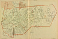
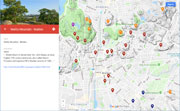
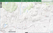
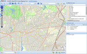
| Malden Maps |
| • |
Malden - Google Maps, Terrain |
| • |
Malden - MassMapper MassGIS |
| • |
Malden - USGS - The National Map |
| • |
Boston North Quadrangle - 2018 (60 MB PDF) - USGS Topo Download |
| • |
City of Malden, O.H. Bailey & Co., 1881 - Norman B. Leventhal Map Center, Boston Public Library |
| • |
Map of Malden, Peter Tufts, 1795 - Norman B. Leventhal Map Center, Boston Public Library |
| • |
Atlas of Malden, Massachusetts, Geo. H. Walker & Co., 1897 - State Library of Massachusetts |
| • |
Malden Maps: 29, 30, 31, 32, Atlas of Middlesex County, Volume 1, George W. Stadly & Co., 1900 - State Library of Massachusetts |
| • |
MapJunction |
| • |
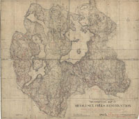
See: Hills of the Middlesex Fells Reservation |
|
|
| Malden Sources |
| • |
The History of Malden, Massachusetts, 1633-1785, Deloraine P. Corey, 1899 - Internet Archive |
| • |
Malden Past and Present, Issued on the Occasion of the Two Hundred and Fiftieth Annivesary, Deloraine P. Corey, 1899 - HathiTrust |
| • |
The Register of the Malden Historical Society, Malden, Massachusetts - Hathitrust |
| • |
Malden, History of Middlesex County, Massachusetts, with Biographical Sketches of Many of its Pioneers and Prominent Men, Duane Hurd, 1890, Vol. 3 - Internet Archive |
| • |
Malden, History of Middlesex County, Massachusetts: Containing Carefully Prepared Histories of Every City and Town in the County, Samuel A. Drake, 1880, Vol. 2 - Internet Archive |
| • |
The Waite Family of Malden of Malden, Massachusetts, Deloraine P. Corey, 1913 - Internet Archive |
| • |
Malden, MHC Reconnaissance Survey Town Report (PDF), 1980 - Massachusetts Historical Commission |
| • |
Job #1696, Bell Rock Park, Malden, Mass. - Olmsted Archives, NHS, NPS |
| • |
Job #10567, Granada Highlands, Malden, Mass. (plans) - Olmsted Archives, NHS, NPS |
| • |
Atlas of the boundaries of the city of Malden, Middlesex County, 1898 - State Library of Massachusetts |
| • |
Malden Open Space and Recreation Committee - City of Medford |
| • |
Malden, MA Open Space and Recreation Plan Update - 2017 Survey Map (PDF) - City of Medford |
| • |
See: Hills of the Middlesex Fells Reservation |
|
|
| Footnotes |
| 1 |
John Waite, pg. 226, History of the Military Company of the Massachusettsn, Vol. 1, 1637-1738, 1895 - Internet Archive |
| 2 |
Joseph Hills and the Massachusetts Laws of 1648, Deloraine P. Corey - Google ebook |
| 3 |
Thomas Coitmore, pg. 87, History of the Military Company of the Massachusettsn, Vol. 1, 1637-1738, 1895 - Internet Archive |
| 4 |
The Lost Mill Village of Middlesex Fells, Douglas L. Heath and Alison C. Simcox, 2017 - Google ebook preview |
|
Harper's Popular Cyclopaedia of United States History, pg. 486, Benson J. Lossing, 1898 - Google ebook |
| |
The Governor's Lady, Why one of Malden's Public Parks is called "Coytmore Lea", pg. 13, Register of the Malden Historical Society. Vol. 6, 1919-1920 - HathiTrust |
| |
The Rainborowes: One Family's Quest to Build a New England, Adrian Tinniswood, 2013 - Google ebook preview |
|
The Story of the American Merchant Marine, pg. 38, John R. Spears, 1919 - Google ebook |
| 5 |
The tragedy of John Winthrop’s widow, Christy K. Robinson, 2011 - William & Mary Dyer |
|
|
.jpg)