| Roslindale was originally part of the town of Roxbury. In 1851, current day Jamaica Plain, Roslindale and West Roxbury seceded from Roxbury. The area voted in 1873 to be annexed to the City of Boston. The Roslindale was suggested in 1879 by a prominent local resident, John Pierce, because he the terrain reminded him of the village of Roslin, Scotland. |
|
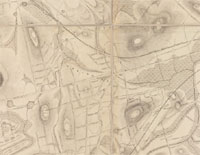
| Hills of Roslindale - Boston, Mass. |
| Chapel Hill |
| • |
Google Maps | Google Earth - Google |
| • |
Forest Hills Cemetery (PDF), - Forest Hills Cemetery |
| • |
"...Chapel Hill, north of Lake Dell...", Drake, pg. 233,1908 - HathiTrust |
| • |
"...It is now proposed that Lake Dell, which, supplied by its own springs alone, would be little
better than a stagnant or grassy pool, should be filled up....", Crafts, pg. 83,1858 - Internet Archive |
|
| Consecration Hill |
| • |
Google Maps | Google Earth - Google |
| • |
Forest Hills Cemetery (PDF), - Forest Hills Cemetery |
| • |
"...From the eastern end of Lake Dell, Magnolia Avenue leads to the summit of Consecration Hill,
which rises in an angle of the cemetery, and touches its northern and eastern boundaries. As
its name indicates, the consecration services were performed here, at the foot of its southern slope, while the audience which was gathered there on that day were ranged upon the hill-side....", Crafts, pg. 84,1858 - Internet Archive |
|
| Cypress Hill |
| • |
Google Maps | Google Earth - Google |
| • |
Forest Hills Cemetery (PDF), - Forest Hills Cemetery |
| • |
"...Cypress Hill, overlooking the neighboring cemetery of Mount Hope...", Drake, pg. 233,1908 - HathiTrust |
| • |
"...One of the earliest was the Firemen's lot on Cypress Hill, established in 1856 to honor Boston firefighters....", Forest Hill Cemetery, National Park Service, pg. 28, (PDF) - Jamaica Plain Historical Society |
|
| Eliot Hill |
| • |
Google Maps | Google Earth - Google |
| • |
Forest Hills Cemetery (PDF), - Forest Hills Cemetery |
| • |
"...The Eliot Hills, which take their name from the Apostle Eliot, are four eminences in the southwestern part of the cemetery ; or, more correctly, there is but one hill, having several small ridges or undulations near its summit....", Crafts, pg. 92,1858 - Internet Archive |
| • |
John Eliot (missionary), "...John Eliot (c. 1604 – May 21, 1690) was a Puritan missionary to the American Indians whom some called 'the apostle to the Indians' and the founder of Roxbury Latin School in the Massachusetts Bay Colony in 1645..." - Wikipedia |
|
| Fern Hill |
|
| Fountain Hill |
|
| Metropolitan Hill |
| • |
Google Maps | Google Earth - Google |
| • |
"...Metropolitan Hill was bisected by Metropolitan Avenue....", Sammarco, Roslindale, Images of America, pg. 120, 1997 - Internet Archive |
| • |
"...the vast estate of Henry Sturgis Grew...which was composed of 800 acres of open land in Roslindale and Hyde Park. Woodlands eventually became the Stony Brook Reservation and the George Wright Golf Course ...." Roslindale: Then & Now, Anthony M. Sammarco, 1847 - Google ebook preview |
| • |
"...Henry Grew, The place chosen for a residence had been known as the Noah Withington Estate, and prior to the Withington ownership was the property of a man named Luke Trott...Mr. Grew designates his sightly residence as 'Woodlands,' and from the hillside upon which it stands is a charming view of Hyde Park nestling in the valley of the Neponset, and covering the westerly slope of Fairmount, and of Milton with its famous Blue Hills. From time to time he has added to his extensive domain until it now includes nearly all the several hundred acres known as 'Grew's Woods.' ....", Hyde Park Historical Record, Vol. 1 No. 2, pg. 18 1891 - Internet Archive |
| • |
Capt. Johns Hill, Atlas of West Roxbury, City of Boston, G. W. Bromley & Co., Plate 26, 1924 - State Library of Massachusetts |
|
| Milton Hill |
|
| Mount Dearborn |
| • |
Google Maps | Google Earth - Google |
| • |
"...One of the most attractive spots at Forest Hills is the grotto on Dearborn Hill...", Drake, pg. 233,1908 - HathiTrust |
| • |
Forest Hills Cemetery (PDF), - Forest Hills Cemetery |
| • |
"...From the Fountain dell a steep path leads up the southern side of Mount Dearborn, and then
up its more gentle western slope to the top. As seen from the plain on the west of the hill....", Crafts, pg. 87,1858 - Internet Archive |
| • |
Henry Alexander Scammell Dearborn, "...He was elected Mayor of Roxbury, Massachusetts in 1846 and served from 1847 to 1851. In 1848, while he was Mayor of Roxbury, Dearborn designed and founded the Forest Hills Cemetery. He also designed Mount Auburn Cemetery in Cambridge, Massachusetts, the first rural landscaped cemetery in the nation.." - Wikipedia |
|
| Mount Warren |
| • |
Google Maps | Google Earth - Google |
| • |
Forest Hills Cemetery (PDF), - Forest Hills Cemetery |
| • |
"...the large hill south of Consecration Hill, named for the illustrious Warren...", Drake, pg. 233,1908 - HathiTrust |
| • |
"...In the first annual report of the commissioners, Gen. Dearborn suggested the propriety of erecting a bronze statue of Major General Joseph Warren, in some fitting place on this hill, which is named in honor of that illustrious man...", Crafts, pg. 90,1858 - Internet Archive |
| • |
Joseph Warren, "...Dr. Joseph Warren (June 11, 1741 – June 17, 1775) was an American physician who played a leading role in American Patriot organizations in Boston in the early days of the American Revolution...Warren enlisted Paul Revere and William Dawes on April 18, 1775, to leave Boston and spread the alarm that the British garrison in Boston was setting out to raid the town of Concord ...Warren had been commissioned a Major General in the colony's militia shortly before the June 17, 1775 Battle of Bunker Hill. Rather than exercising his rank, Warren served in the battle as a private soldier, and was killed in combat when British troops stormed the redoubt atop Breed's Hill.." - Wikipedia |
|
| Peters Hill |
| • |
Google Maps | Google Earth - Google |
| • |
Plan of the Arnold Arboretum Jamaica Plain, Mass., Harvard University, 1909 - Norman B. Leventhal Map Center, Boston Public Library |
| • |
A History of the Arnold Arboretum, "...Benjamin Bussey purchased the land now called Peters Hill from farmer John Davis in 1837, and the tract of some 68 acres was added to the Arboretum under a second indenture with the City of Boston in 1894....Known originally as Davis Hill, it was later named after Andrew James Peters, a member of the United States House of Representatives from 1907 to 1914, and the Mayor of Boston from 1918 to 1922...", - Jamaica Plain Historical Society |
|
| Snowflake Hill |
|
| Suicide Hill |
|
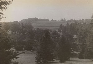
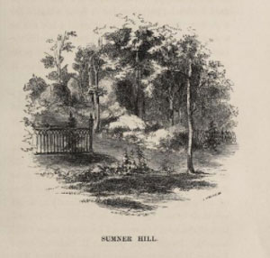
| Sumner Hill |
| • |
Google Maps | Google Earth - Google |
| • |
"...One of the most picturesque groups of these rocks is on the lot of Gen. William H. Sumner, called Sumner Hill, on the western slope of Mount Warren....", Crafts, pg. 100,1858 - Internet Archive |
| • |
"...One of the most remarkable of these groups is in the lot of Gen. William H. Sumner, on the western slope of Mount Warren, where stands a statue of great beauty, representing the Angel of the Tomb protecting the ashes of the dead. The Sumner shield and arms, also a medallion head, ornament the base of the statue...", Drake, pg. 233,1908 - HathiTrust |
|
| Weld Hill |
| • |
Google Maps | Google Earth - Google |
| • |
Weld Family, "...Captain Joseph Weld (1599–1646), the youngest of the three Weld immigrants, is the ancestor from whom the richest and most famous Welds descend. As an award for his participation in the Pequot War of 1637 and subsequent negotiations, the colonial legislature granted Weld 278 acres in the town of Roxbury. Captain Weld's land is now much of present-day Jamaica Plain and Roslindale. With the wealth generated from this grant, Joseph Weld became one of the first donors to Harvard and a founder of the Ancient and Honorable Artillery Company of Massachusetts..." - Wikipedia |
|
|
|
 |
|
| Peters Hill |
 |
|
| Suicide Hill |
 |
|
| Sumner Hill |
 |
|
| Weld Hill |
 |
|
|
| Roslindale Maps |
| • |
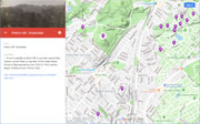
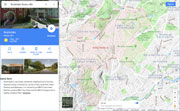
Roslindale - Google Maps, Terrain |
| • |
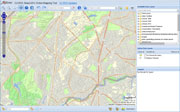
Roslindale - MassMapper MassGIS |
| • |
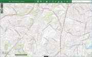
Roslindale - USGS - The National Map |
| • |
Boston South Quadrangle - 2018 (60 MB PDF) - USGS Topo Download |
| • |
Newton Quadrangle - 2018 (60 MB PDF) - USGS Topo Download |
| • |
USGS Historical Topographic Map Explorer |
| • |
Map of the Town of Roxbury, Massachusetts, John G. Hales, 1832 - Norman B. Leventhal Map Center, Boston Public Library |
| • |
City of Roxbury, Massachusetts, Charles Whitney, 1849 - Norman B. Leventhal Map Center, Boston Public Library |
| • |
Plan of Town of West Roxbury, Mass., Theodore B. Moses, 1873 - Norman B. Leventhal Map Center, Boston Public Library |
| • |
Atlas of Dorchester, West Roxbury, and Brighton, West Roxbury, Plate 17, L.J. Richards, 1899 - State Library of Massachusetts |
| • |
Plan of the Arnold Arboretum, Jamaica Plain, Mass., Harvard University, 1909 - Norman B. Leventhal Map Center, Boston Public Library |
| • |
Forest Hills Cemetery (PDF), - Forest Hills Cemetery |
| • |
Stony Brook Reservation Trail Map (PDF), Stony Brook Reservation - DCR, Commonwealth of Massachusetts |
| • |
Atlas of Roxbury, Geo. W. & Walter S. Bromley, 1899 - State Library of Massachusetts |
| • |
MapJunction |
|
|
| Roslindale Sources |
| • |
Roslindale: Images of America, Anthony M. Sammarco, 1997 - Internet Archive |
| • |
Roslindale: Then & Now, Anthony M. Sammarco, 2012 - Google ebook preview |
| • |
Hyde Park Historical Record, Vol. 1, No. 1-4, 1891-1893, William A. Mowry - Internet Archive |
| • |
Jamaica Plain Historical Society |
| • |
The Town of Roxbury its Memorable Persons and Places, A Volume of Records Relating to the Early History of Boston, Francis S. Drake, Vol. 34, 1908 - HathiTrust |
| • |
The Roxbury Magazine, All Souls Unitarian Church, 1899 - Internet Archive |
| • |
The Arnold Arboretum - Havard University |
| • |
Forest Hills Cemetery: its Establishment, Progress, Scenery, Monuments, etc., William A. Crafts, 1858 - Internet Archive |
| • |
Forest Hills Cemetery (PDF), National Register of Historic Places, National Park Service - Jamaica Plain Historical Society |
| • |
Forest Hills Education Trust |
| • |
The Arnold Arboretum - Havard University |
|
|
|