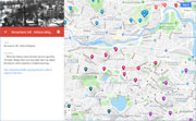
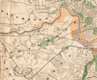
| Hills of Allston/Brighton - Boston, Mass. |
| | Introduction | Hills | Maps | Sources | |
| In 1630 the land comprising present-day Allston/Brighton and Newton was assigned to Watertown. In 1634, ownership of the area was transferred to Newetowne, later renamed Cambridge. Brighton separated from Cambridge in 1807 and was annexed to Boston in 1874. The neighborhood of Allston was also formerly part of the town of Brighton, but is now often considered separately, leading to the moniker Allston/Brighton for the combined area. Brighton is named after a city in England. Allston was named after the American painter and poet Washington Allston. |
|
| Hills of Allston/Brighton - Boston, Mass. |
| Academy Hill |
|
| Agricultural Hill |
|
| Bigelow Hill |
| • |
Google Maps | Google Earth - Google |
| • |
Samuel Bigelow, "..Bigelow Street and Bigelow Hill in Oak Square were named for Samuel Bigelow, who purchased the old Faneuil Estate in 1839. Bigelow built a conservatory west of the mansion..." - The Bigelow Society |
| • |
"..The Bigleow Family...", Winship, Vol. 1, pg. 51, 1899 - Internet Archive |
| • |
"..The Fanueil Mansion...The Fanenil family was of the French Huguenots who fled from La Rochelle, France, in 1685...Peter Faneuil, the munificent donor of Faneuil Hall, the old 'cradle of liberty, was born in 1700.'...", Winship, Vol. 1, pg. 47, 1899 - Internet Archive |
|
| Brooks Hill |
| • |
Google Maps | Google Earth - Google |
| • |
"..In Brighton are Nevins Hill, 192; Bigelow Hill, 165; Brooks Hill, one-fourth mile east of last, 90; Brighton Hill, 140; Strong's Hill, one-fourth mile south-east from last, 175...", Upham, pg. 227, 1880 - HathiTrust |
| • |
Faneuil, Brooks and Parsons St Area, "...Brooks House, the farmhouse of Brooks estate, the largest farm in Brighton in the 1870s..." - Brighton Allston Historical Society |
| • |
"..George H. Brooks was of sterling character and one of the comparatively few of whom it may be truthfully said: 'His word is as good as his bond.'...", Winship, Vol. 1, pg. 157, 1899 - Internet Archive |
|
| Foster Street Hill |
| • |
Google Maps | Google Earth - Google |
| • |
Foster Street Hill , "...The wood opens up to a ledge of puddingstone 75 feet above the lawns of the estate. The views of St. John's Seminary and the spires of Boston College are dramatic. .....", Boston Urban Wilds Report, pg. 47, 1990, - Internet Archive |
|
| Foster Street Rock |
| • |
Google Maps | Google Earth - Google |
| • |
Foster Street Rock, "..The rock is a 30-foot-high mass of glacially polished mudstone
between a parking lot and house lots. It is as smooth as any natural rock
can get......", Boston Urban Wilds Report, pg. 48, 1990, - Internet Archive |
|
| Hunnewell Hill |
| • |
Google Maps | Google Earth - Google |
| • |
Oak Square History, "..Hunnewell Hill may have been named for the Francis Hunnewell family who owned extensive real estate throughout Allston-Brighton during the mid-to-late 19th century...Variously called Bowen Hill, Lime Hill and Washington Hill during the 18th and the early 19th century, Hunnewell Hill was a sparsely populated place, distinguished mainly by colonial farms, orchards, Indian villages, and primitive roads...." - Brighton Allston Historical Society |
| • |
"...Maintaining a general southerly direction after leaving Hunnewell Hill, we cross a narrow valley ...", Burrows, pg. 551, 1909 - Google ebook |
| • |
"...In the northeastern corner of the city rises the long plateau of Brighton Hill, or Hunnewell Hill, a part of which is within the corporate limits of Boston...", Sweetster, pg. 50, 1889 - Internet Archive |
| • |
"...The Hunnewell Club building at the corner of Church and Eldredge Streets in Newton is one of the last of the old club
house buildings surviving in the city...", History of the Hunnewll Club of Newton, 1987, - Internet Archive |
| • |
"..Daniel Bowen purchased the estate about 1791 and the same year opened an exhibition of wax figures at the north
end of Boston. The Brighton estate was situated on what was afterwards known as Bowen Hill....About 1815 Mr. Bowen sold his estate to Joseph Peabody who in 1820 sold it to Capt. Wm. P. Matchett and in the deed the estate is called Lime Grove...", Winship, Vol. 1, pg. 35, 1899 - Internet Archive |
|
| Kennedy Rock |
| • |
Google Maps | Google Earth - Google |
| • |
Kennedy Rock, "..The most dramatic natural feature along Brighton ' s busy Cambridge
Street, this mass of Roxbury conglomerate rises 50 feet from the
sidewalk's edge. The rock is characterized by a long, jagged ridge with
two peaks. ...", Boston Urban Wilds Report, pg. 46, 1990, - Internet Archive |
|
| Leamington Rock |
| • |
Google Maps | Google Earth - Google |
| • |
Leamington Rock, "..Leamington Rock, although severely eroded, is an imposing cliff
that looms over a handsome row of two-story brick row houses that
characterizes Leamington Road. It is a fine-grain sand member of the
Roxbury conglomerate group of stones. It is heavily fractured by
continual water runoff. It is a wall nearly 60 feet tall that exposes what
is beneath Nottinghill Road....", Boston Urban Wilds Report, pg. 46, 1990, - Internet Archive |
|
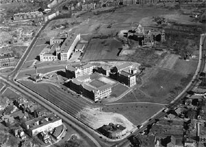
| Nevins Hill |
| • |
Google Maps | Google Earth - Google |
| • |
"..The most prominent building is that of David Nevins. Its position on Nevins Hill makes it observable from all parts of Brighton...", Winship, Vol. 1, pg. 14, 1899 - Internet Archive |
| • |
David Nevins, Sr. (1809-1881) , "..Nevins resided for many years on an estate in Brighton called "Bellvue," a property that today comprises the grounds of St. Elizabeth's Hospital and the former St. Gabriel's Monastery. The hill on which Bellvue Estate stood is commonly referred to as Nevins Hill...", Famous Allston-Brighton Residents, Past and Present - Brighton Allston Historical Society |
| • |
"..Mr. Nevins improved the grounds of his Brighton mansion which is situated on the top of the hill, about five hundred feet from Washington Street and reached by an easy ascent through a lane shaded by trees...", Winship, Vol. 1, pg. 18, 1899 - Internet Archive |
|
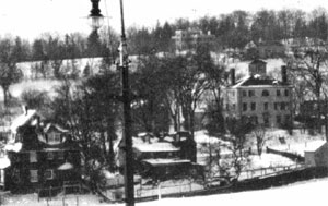
| Nonantum Hill |
| • |
Google Maps | Google Earth - Google |
| • |
John Eliot and Nonantum, "...When the Indians inquired what name to give their Christian village, Eliot recommended that it be called Nonantum, which signifies in English rejoicing..." - Brighton Allston Historical Society |
| • |
"..In Brighton are Nevins Hill, 192; Bigelow Hill, 165; Brooks Hill, one-fourth mile east of last, 90; Brighton Hill, 140; Strong's Hill, one-fourth mile south-east from last, 175...", Upham, pg. 227, 1880 - Google ebook |
| • |
Horticulture and Nonantum Hill, "..William Strong who owned most of Nonantum Hill including the Nonantum Hill Nursery prior to William Elliott. ...." - Brighton Allston Historical Society |
| • |
Oak Square History, "..Brighton's horticultural industry also expanded in the 1830s and 1840s. The Nonantum Vale Nursery, Breck's Gardens, and Horace Gray's Grapery on Nonantum Hill arose alongside Winships' Gardens, making Brighton one of the two or three most important horticultural centers in the Boston area...." - Brighton Allston Historical Society |
| • |
"..In Brighton are Nevins Hill, 192; Bigelow Hill, 165; Brooks Hill, one-fourth mile east of last, 90; Brighton Hill, 140; Strong's Hill, one-fourth mile south-east from last, 175...", Upham, pg. 227, 1880 - HathiTrust |
|
| Notting Hill |
| • |
Google Maps | Google Earth - Google |
| • |
Boston's Paul Revere Pottery, "..A short time later the Paul Revere Pottery acquired a piece of land in the Aberdeen section of Brighton, atop Nottingham Hill (later renamed Nottinghill), the highest elevation in that community..." - Brighton Allston Historical Society |
| • |
Euston Path Rock, "...Euston Path Rock is the only City-owned, designated urban wild in Brighton. A massive puddingstone outcrop, rising from Euston Street and back to Notting Hill, dominates the site..." - City of Boston |
| • |
Perhaps - Notting Hill, "...West London district...The origin of the name 'Notting Hill' is uncertain though an early version appears in the Patent Rolls of 1356 as Knottynghull..." - Wikipedia |
|
| Ringer Park |
|
| Turnpike Overlook |
| • |
Google Maps | Google Earth - Google |
| • |
Turnpike Overlook, "..Newton Street rises 75 feet from the level of railroad tracks and the speedways of the Mass Pike. Along it, Turnpike Overlook affords a stunning view of the Charles River, the Arsenal Mall, and the rooftops and tree line of Newton and Cambridge as far north as Porter Square...", Boston Urban Wilds Report, pg. 46, 1990, - Internet Archive |
|
|
|
 |
|
| Nevins Hill |
 |
|
| Nonantum Hill |
 |
|
|
|
| Allston/Brighton Sources |
| • |
Historical Brighton, An Illustrated History of Brighton and its Citizens, Vol. 1, Vol. 2, 1899, John P.C. Winship - Internet Archive |
| • |
Brighton, History of Middlesex County, Massachusetts: Containing Carefully Prepared Histories of Every City and Town in the County, Samuel A. Drake, 1880, Vol. 1 - Internet Archive |
| • |
The Bull in the Garden, Allston-Brighton, William P. Marchione, 1986 - Internet Archive |
| • |
Allston-Brighton, William P. Marchione, 1996 - Internet Archive |
| • |
Brighton, Boston 200 Neighborhood History Series, 1976 - Internet Archive |
| • |
Brighton Allston Historical Society |
| • |
Brighton, History of Middlesex County, Massachusetts: Containing Carefully Prepared Histories of Every City and Town in the County, Samuel A. Drake, Vol. 1, 1880 - Internet Archive |
| • |
Brighton in the Last Hundred Years, The Memorial History of Boston including Suffolk County, Massachusetts, 1630-1880, Vol. 3, Francis S. Drake, 1881 - Internet Archive |
| • |
Glacial Drift in Boston and its Vicinity, Warren Upham, Proceedings of the Boston Society of Natural History, Vol. 20, pg. 220, 1880 - HathiTrust |
|
|
|