| Dorchester was first settled in 1630 as a seperate town. It was named after the city of Doechester in England. The town was annexed in pieces by Boston starting in 1804, and finishing in 1870. Portions of original town of Dorchester became the separate towns of Hyde Park (1868 and later annexed to Boston in 1912), Milton (1662), and Stoughton (1726, itself later subdivided). |
|
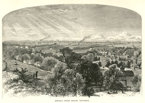
| Hills of Dorchester - Boston, Mass. |
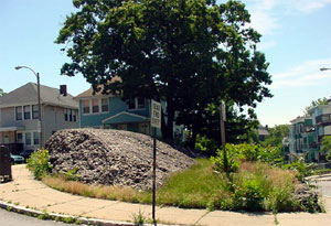
| Adams Rock |
|
| Ashmont Hill |
| • |
Google Maps | Goggle Earth - Google |
| • |
Ashmont Hill, "...Ashmont was named for a Neponset Indian who was kinsman to Chickatawbut, Sachem of the Neponset Indians..." - Dorchester Antheneum |
|
| Carruths Hill |
| • |
Google Maps | Goggle Earth - Google |
| • |
Carruth Street / Peabody Square, " [Internet Archive] ...This area was developed with "custom-built" houses between 1877 and 1915 on land that businessman and community activist Herbert C. Carruth inherited from his father, Nathan Carruth, a China Trade merchant and early railroad magnate..." - Dorchester Antheneum |
| • |
Nathan Carruth, "...In 1847 Carruth moved to Dorchester, laying out at great expense a most attractive estate in what is now known as Ashmont..." - Wikipedia |
|
| Codman Hill |
| • |
Google Maps | Goggle Earth - Google |
| • |
"...He owned land on Duncan's Hill, now Spurr's or Codman's Hill...", Clapp, pg. 109, 1859 - Internet Archive |
| • |
Codman Hill, "...Codman Hill in Dorchester was named for the Reverend John Codman who was pastor of Codman Square's Second Church from 1808-1847. John Codman (1782-1847) was born in Boston and graduated from Harvard University in 1802. Although he studied law, he went on to pursue theological training in Scotland and became an influential preacher. The Codman Hill area represents a small portion of Codman's estate which encompassed over 64 acres..." - Dorchester Antheneum |
| • |
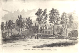
Codman mansion, [Internet Archive] " ...The Codman Mansion on Codman Hill, built by Seth Thayer in 1790, and purchased by John Codman when he became pastor of Second Church in 1808...The explosion of an oil stove in February, 1923, led to the fire that nearly demolished the house. The building was razed the following year..." - Dorchester Historical Society |
| • |
"...1703. Aug. 16th, Mr. Robert Spurr died, aged 93 years. He had been a very prominent man in the town, and more liberal in his religious belief than most of his contemporaries...", Clapp, pg. 109, 1859 - Internet Archive |
| • |
"...Nathaniel Duncan...among the first comers - he appears in the Town Records as grantee of land in 1633 and '37 ; Selectman of the town from 1635 to '45; one of the six who first signed the Church Covenant with Mr.
Mather; charter member of Artillery Company in 1637; freeman 1635; was a successful merchant...", Clapp, pg. 50, 1859 - Internet Archive |
|
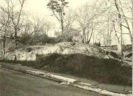
| Fernald Terrrace Rock |
| • |
Google Maps | Goggle Earth - Google |
| • |
Fernald Terrace Rock, "...the smallest city-owned urban wild. It consists of a puddingstone outcrop surrounded by sparse cover of grass and weedy vegetation. .....", Boston Urban Wilds - City of Boston |
|
| Geneva Cliffs |
| • |
Google Maps | Goggle Earth - Google |
| • |
Geneva Cliffs "...The site is mostly wooded and contains a rocky ledge rising about forty feet above Bowdoin Street. Small dips and rises of topography lend interest to the site...", Boston Urban Wilds - City of Boston |
|
| Ginger Hill |
| • |
Google Maps | Goggle Earth - Google |
| • |
"...The Macondray House was an elegant Federal mansion...designed to resemble a pagoda, that surmounted Ginger Hill, the western slope of Pope's Hill...", Sammarco, 2000 - Google ebook preview |
| • |
Frederick William Macondray, [Internet Archive] "...Captain Macondray purchased a lovely home in Dorchester, a suburb of Boston. Their new home was called "Rosemont". "This magnificent example of Colonial Architecture was built about 1800 and became the property of Captain Macondray..." - Dorchester Antheneum |
|
| Huntoon Rock |
| • |
Google Maps | Goggle Earth - Google |
| • |
Adams Rock and Huntoon Rock, "...These are two dramatic outcrops of puddingstone at either end of a
block near Dorchester Lower Mills.....", Boston Urban Wilds Report, pg. 71, 1990 - Internet Archive |
| • |
Perhaps descendant of..., Philip Huntoon , "...is said to be the ancestor of all persons in America bearing the name "Huntoon."...They [Indians] also took Philip Huntoon and Jacob Gilman, and carried them to Canada; where, after some time, they purchased their own redemption by building a saw-mill for the governor after the English mode..." - Wikipedia |
|
| Jones Hill |
| • |
Google Maps | Goggle Earth - Google |
| • |
"...Thomas Jones was grantee of Dorchester land in 1635, and one of the first signers of the Church Covenant with Mr. Mather in 1636; Selectman the same year, and often for thirty years after; Deputy in 1638. He lived near the hill still called by his name, and died 1668, aged 75...", Clapp, pg. 60, 1859 - Internet Archive |
|
| Meeting House Hill |
| • |
USGS identified - MassMapper MassGIS - Wrong? |
| • |
Google Maps | Goggle Earth - Google |
| • |
Meeting House Hill, "...This meeting house was replaced in 1645 by a much larger and better on which, in 1670, was removed to Meeting House Hill..." - Dorchester Historical Society |
| • |
Meeting House Hill [Internet Archive] "...The story of Meeting House Hill really begins with the relocation of the First Parish Church ca. 1673 from the corner of Pond and Pleasant Streets to the top of Meeting House Hill. The Meeting house bolstered the Hill's prominence and centrality in town affairs..." - Dorchester Antheneum |
| • |
Meeting House Hill, "...Meeting House Hill was settled in the 17th century by Puritans who arrived on the Mary and John. It was originally called Rocky Hill, after the puddingstone outcroppings along its eastern slope..." - Wikipedia |
| • |
Meeting House Hill - USGS Geographic Names Information System |
|
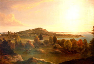
| Mount Bowdoin |
| • |
USGS identified - MassMapper MassGIS |
| • |
Google Maps | Goggle Earth - Google |
| • |
Mt. Bowdoin, [Innternet Archive] "...Mount Bowdoin was named for James Bowdoin [(1726-1790)], the Revolutionary War patriot and governor of Massachusetts during the late 1780's. As early as the mid 18th century. Governor Bowdoin summered on Dorchester's Mt Bowdoin or Bowdoin Hill as it was originally known..." - Dorchester Antheneum |
| • |
James Bowdoin - Wikipedia |
| • |
Mount Bowdoin - USGS Geographic Names Information System |
|
| Mount Ida |
| • |
Google Maps | Goggle Earth - Google |
| • |
"...The Harris-Capen House, or 'Mount Ida' as it was known, was built in 1793 at the summit of Bird Hill...", Sammarco, pg. 36, 1995 - Internet Archive |
| • |
, "...Harris-Capen House or "Mount Ida" was built in 1793 at the summit of Bird's Hill, just west of Meeting House Hill. Sold by Rev. Harris in 1840, it became the home of Nahum Capen family until 1916, when it was demolished and the estate became Ronan Park..." - Dorchester Antheneum |
|
| Popes Hill |
| • |
USGS identified - MassMapper MassGIS |
| • |
Google Maps | Goggle Earth - Google |
| • |
"...From a very early date our name has rested on one of its fair knobs, 'Pope's Hill,' at whose base the Old Colony Railroad has now a station of that name. It was in the great lot originally laid out to Christopher Gibson, but conveyed by him to John Pope in an 'exchange of land,' in 1642...", A History of the Dorchester Pope Family. 1634-1888, pg. 16, Charles H. Pope, 1888 - Internet Archive |
| • |
"...The Spaulding House was an imposing cupolaed mansion...built on the crest of Pope's Hill. It was built by Mahlon D. Spaulding, who dubbed the hill Spaulding Hill in the 1860s...", Sammarco, 2000 - Google ebook preview |
| • |
Popes Hill- USGS Geographic Names Information System
Variant name: Mount Assabet |
|
| Savin Hill |
| • |
USGS identified - MassMapper MassGIS |
| • |
Google Maps | Goggle Earth - Google |
| • |
List of Dorchester Place Names through History, [Internet Archive] "...Savin Hill, Rock Hill, Old Hill, Captain's Neck, the hill on a promontory of land at the eastern end of Savin Hill Avenue, ending in Fox Point. Allen's Plain (Pleasant St.) and Rock Hill were the area first settled by the English colonists in 1630. The hill became known in the early 19th century as Savin Hill due to the great numbers of savin (cedar) trees growing there..." - Dorchester Antheneum |
| • |
"...The Tuttle House was at the corner of Savin Hill Avenue and Tuttle Street. One of Boston's first seaside hotels, it was owned by Joseph Tuttle, who renamed 'Old Hill' as 'Savin Hill' in 1822...", Sammarco, pg. 9, 1995 - Internet Archive |
| • |
"...Savin Hill, an eminence
so named from the trees that cover it...", Elias Nason, A Gazetteer of the State of Massachusetts, pg. 110, 1874 - HathiTrust |
| • |
Savin Hill- USGS Geographic Names Information System |
|
|
|
 |
|
 |
|
| Carruth Hill |
 |
|
| Codman Hill |
 |
|
| Fernald Terrace Rock |
 |
|
| Huntoon Rock |
 |
|
| Jones Hill |
 |
|
| Meeting House Hill |
 |
|
| Mount Bowdoin |
 |
|
| Savin Hill |
 |
|
 |
|
| |
|
| Dorchester Maps |
| • |
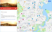
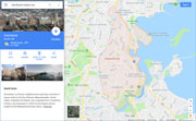
Dorchester - Google Maps, Terrain |
| • |
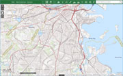
Dorchester - MassMapper MassGIS |
| • |
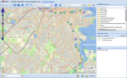
Dorchester - USGS - The National Map |
| • |
Boston South Quadrangle - 2018 (60 MB PDF) - USGS Topo Download |
| • |
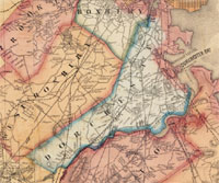
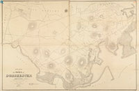
A Map of the Towns of Dorchester and Milton, Edmund J. Baker, 1831 - Norman B. Leventhal Map Center, Boston Public Library |
| • |
Map of Dorchester Mass, Elbridge Whiting, 1850 - Norman B. Leventhal Map Center, Boston Public Library |
| • |
Atlas of South Boston and Dorchester, G.M. Hopkins & Co., 1874 - State Library of Massachusetts |
| • |
Map of the City and Vicinity of Boston Massachusetts, James C. Sidney, 1853 - Norman B. Leventhal Map Center, Boston Public Library |
| • |
Boston Harbor, Massachusetts, U.S. Coast Survey Office, 1863 - Norman B. Leventhal Map Center, Boston Public Library |
| • |
Plan of the Town of Dorchester, Thomas W. Davis, 1870 - Norman B. Leventhal Map Center, Boston Public Library |
| • |
Map of Boston, Showing Health Districts and Undrained and Drained Land, Heliotype Printing Co., 1879 - Norman B. Leventhal Map Center, Boston Public Library |
| • |
Map of Dorchester and Quincy, Massachusetts, Dudley & Greenbough, 1868 - Norman B. Leventhal Map Center, Boston Public Library |
| • |
Plan of Boston and its Vicinity, Showing the Drainage Area of Stony Brook, H.M. Wightman, 1863 - Norman B. Leventhal Map Center, Boston Public Library |
| • |
Dorchester Maps - [Internet Archive] Dorchester Atheneum |
|
|
| Dorchester Sources |
| • |
Annals of the Town of Dorchester, James Blake, 1846 - Internet Archive |
| • |
History of the Town of Dorchester, Massachusetts, Ebenezer Clapp, 1859 - Internet Archive |
| • |
Good old Dorchester: A Narrative History of the Town, 1630-1893, William D. Orcutt, 1908 - Internet Archive |
| • |
Dorchester: Images of America, Anthony M. Sammarco, 1995 - Internet Archive |
| • |
Dorchester: Images of America, Vol. II, Anthony M. Sammarco, 2000 - Google ebook preview |
| • |
Dorchester Historical Society |
| • |
Dorchester Antheneum |
| • |
1990 Boston Urban Wilds Report, Boston Natural Areas Fund, 1990 - Internet Archive |
|
|
|