|
|
|
|
|
| • |
About |
| • |
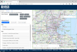
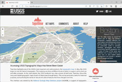
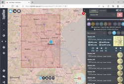
USGS - TopoView Download |
| • |
Blue Hills Quadrangle - 2018 (PDF) - USGS Topo Download |
| • |
Boston North Quadrangle - 2018 (PDF) - USGS Topo Download |
| • |
Boston South Quadrangle - 2018 (PDF) - USGS Topo Download |
| • |
Cohasset Quadrangle - 2018 (PDF) - USGS Topo Download |
| • |
Concord Quadrangle - 2018 (PDF) - USGS Topo Download |
| • |
Hull Quadrangle - 2018 (PDF) - USGS Topo Download |
| • |
Lexington Quadrangle - 2018 (PDF) - USGS Topo Download |
| • |
Lynn Quadrangle - 2018 (PDF) - USGS Topo Download |
| • |
Nantasket Quadrangle -: 2018 (PDF) - USGS Topo Download |
| • |
Natick Quadrangle - 2018 (PDF) - USGS Topo Download |
| • |
Newton Quadrangle - 2018 (PDF) - USGS Topo Download |
| • |
Norwood Quadrangle - 2018 (PDF) - USGS Topo Download |
| • |
Reading Quadrangle - 2018 (PDF) - USGS Topo Download |
| • |
Salem Quadrangle - 2018 (PDF) - USGS Topo Download |
| • |
Weymouth Quadrangle - 2018 (PDF) - USGS Topo Download |
| • |
Wilmington Quadrangle - (PDF) - USGS Topo Download |
|
|
|
|
Massachusetts |
| • |
Topographical Map of the State of Massachusetts, H.F. Walling, Simeon Borden, 1861 - Norman B. Leventhal Map Center, Boston Public Library |
| • |
Official topographical atlas of Massachusetts from astronomical, trigonometrical and various local surveys, H.F. Walling, 1871 - State Library of Massachusetts | Stanford Libraries |
| • |
Map of the State of Massachusetts, Simeon Borden, Arthur A. Shurtleff, 1876 - Norman B. Leventhal Map Center, Boston Public Library |
| • |
Atlas of Massachusetts, O.W. Walker, 1891 - David Rumsey Map Collection
Plate 4, Plate 5 |
| • |
Atlas of Massachusetts, O.W. Walker, 1892 - State Library of Massachusetts |
|
|
|
Boston and Vicinty |
| • |
Map of Boston and its Vicinity from Actual Survey, John G. Hales, 1819 - Norman B. Leventhal Map Center, Boston Public Library |
| • |
Map of the Existing and Proposed Circumferential Thoroughfares, Arthur A. Shurtleff, 1909 - Norman B. Leventhal Map Center, Boston Public Library |
| • |
Atlas of city of Boston, Boston proper and Back Bay, G.W. Bromley 1938 - State Library of Massachusetts |
| |
|
|
Essex County |
| • |
Map of Essex County, Massachusetts, Henry F. Walling, 1856 - Library of Congress |
| • |
Atlases - Southern Essex District Registry of Deeds |
| |
|
|
Middlesex County |
| • |
Map of Middlesex County, Massachusetts, Henry F. Walling, 1856 - Library of Congress |
| • |
Plan of Middlesex County, Massachusetts, Estes & Lauriat, 1879 - Library of Congress |
| • |
Atlas of Middlesex County, Massachusetts, Vol. 1, Geo. W. Stadly & Co., 1900 - State of Masachusetts |
| • |
Atlas of Middlesex County, Massachusetts, Vol. 2, Geo. W. Stadly & Co., 1906 - State of Masachusetts |
| • |
Map of the Cambridge Region, Charles D. Elliot, The Birds of the Cambridge Region of Massachusetts, pg. 10, William Brewster, 1906. - Internet Arvice |
|
|
|
Norfolk County |
| • |
Map of Norfolk County, Massachusetts, Henry F. Walling, 1853 - Norman B. Leventhal Map Center, Boston Public Library |
| • |
Map of Norfolk County, Massachusetts, Henry F. Walling, 1858 - David Ramsey Map Collection |
| • |
Map of Norfolk County, Massachusetts, Smith & Bumstead, 1858 - Library of Congress |
| • |
Atlas of Norfolk County, Massachusetts, Comstock & Cline, 1876 - Old Maps |
| |
|
|
Suffolk County |
| • |
Atlas of the County of Suffolk, Vol. 1, Boston Proper, G.M. Hopkins & Co., 1874 - Harvard Library |
|
| 1890 TOPOGRAPHICAL ATLAS OF MASSACHUSETTS |
|
|
|
|
| • |
About - Social Networks and Archival Context |
| • |
Atlas of the boundaries of the city of Boston, Suffolk County and town of Brookline, Norfolk County, 1902 - State Library of Massachusetts |
| • |
Atlas of the boundaries of the town of Lynn, Essex County, Massachusetts, 1880 - State Library of Massachusetts |
| • |
Atlas of the boundaries of the town of Nahant, Essex County, Massachusetts, 1896 - State Library of Massachusetts |
| • |
Atlas of the boundaries of the town of Arlington, Middlesex County, 1901 - State Library of Massachusetts |
| • |
Atlas of the boundaries of the cities of Cambridge, Somerville, Waltham and towns of Belmont, Burlington, Lexington, Watertown, Middlesex County, 1903 - State Library of Massachusetts |
| • |
Atlas of the boundaries of the city of Chelsea, Suffolk County, 1898 - State Library of Massachusetts |
| • |
Atlas of the boundaries of the city of Everett, Middlesex County, 1898 - State Library of Massachusetts |
| • |
Atlas of the boundaries of the town of Malden, Middlesex County, 1898 - State Library of Massachusetts |
| • |
Atlas of the boundaries of the city of Medford, Middlesex County, 1898 - State Library of Massachusetts |
| • |
Atlas of the boundaries of the town of Melrose, Middlesex County, 1898 - State Library of Massachusetts |
| • |
Atlas of the boundaries of the city of Newton, Middlesex County, 1874 - State Library of Massachusetts |
| • |
Atlas of the boundaries of the city of Somerville, Middlesex County, 1874 - State Library of Massachusetts |
| • |
Atlas of the boundaries of the town of Stoneham, Middlesex County, 1899 - State Library of Massachusetts |
| • |
Atlas of the boundaries of the town of Winchester, Middlesex County, 1899 - State Library of Massachusetts |
| • |
Atlas of the boundaries of the city of Woburn, Middlesex County, 1899 - State Library of Massachusetts |
| • |
Atlas of the boundaries of the town of Milton, Norfolk County, 1898 - State Library of Massachusetts |
| • |
Atlas of the boundaries of the town of Revere, Suffolk County, 1898 - State Library of Massachusetts |
| • |
Atlas of the boundaries of the town of Winthrop, Suffolk County, 1898 - State Library of Massachusetts |
| • |
Atlas of the boundaries of the towns of Cohasset - Weymouth, Norfolk County Hingham - Hull, Plymouth County, 1901 - State Library of Massachusetts |
| • |
Atlas of the boundaries of the town of Revere, Suffolk County, 1898 - State Library of Massachusetts |
| • |
Atlas of the boundaries of the city of Lynn and towns of Nahant, Saugus, and Swampscott, Essex County and Wakefield, Middlesex County, 1902 - State Library of Massachusetts |
| • |
Atlas of the boundaries of the city of Quincy and towns of Avon, Braintree, Canton, Holbrook, Hyde Park, Milton, Randolph, Stoughton, Norfolk County, 1903 - State Library of Massachusetts |
| • |
Atlas of the boundaries of the cities of Cambridge, Somerville, Waltham and towns of Belmont, Burlington, Lexington, Watertown, Middlesex County, 1903 - State Library of Massachusetts |
| • |
Atlas of the boundaries of the cities of Haverhill, Lawrence and towns of Andover, Boxford, Lynnfield, Methuen, Middleton, North Andover, Essex County North Reading, Reading, Wilmington, Middlesex County, 1906 - State Library of Massachusetts |
| • |
Atlas of the boundaries of the city of Newton, Middlesex County and towns of Dedham, Dover, Foxborough, Medfield, Needham, Norwood, Sharon, Walpole, Wellesley, Westwood, Norfolk County, 1904 - State Library of Massachusetts |
|
|
|
| • |
The Winthrop Map - Circa 1633,
History of America, Justin Winsor, Volume 3, pg. 381, 1886 - Internet Archive |
| • |
The South part of New England, as it is Planted his year, 1634, William Wood, 1635 - Norman B. Leventhal Map Center, Boston Public Library | New Englands Prospect - Gutenberg | About - JSTOR |
|
|