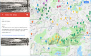
| Hills of Milton, Mass. |
| | Hills | More about Milton's USGS-listed hills | Maps | Sources | |
| Academy Hill |
| • |
USGS identified - MassMapper MassGIS |
| • |
Google Maps | Google Earth - Google |
| • |
"...Academy Hill, from which rise the spires of the Milton churches, and the lower range of the Blue Hills crowned with forests, with the interlaying vallev of green fields and cultivated lands, form a striking picture...", Teele, pg. 103, 1887 - Internet Archive |
| • |
"...The Milton Academy building once stood at the crest of Academy Hill, the area of Milton Centre now occupied by Milton and Town Hall and the Central Fire House...", Sammarco, 2010 - Google ebook preview |
| • |
Milton Academy - Warren Hall - Massachusetts Cultural Resource Information System (MACRIS) |
| • |
Academy Hill - USGS Geographic Names Information System |
|
| Breakneck Ledge |
|
| Breeze Hill |
|
| Brush Hill |
| • |
USGS identified - MassMapper MassGIS |
| • |
Google Maps | Google Earth - Google |
| • |
"...The tradition is, that shortly before the settlement of the country a great forest fire swept over the hill, consuming the trees with everything in its pathway, and that over the burnt district sprang up a thick growth of bushes; from this circumstance it took the name of Brush Hill, which it has never lost. This hill was early occupied. The open tields, strong soil, and wide views drew many of the first settlers to this section...", Teele, pg. 172, 1887 - Internet Archive |
| • |
Brush Hill Historic District - Massachusetts Cultural Resource Information System (MACRIS) |
| • |
Brush Hill - USGS Geographic Names Information System |
|
| Cary Hill |
| • |
Google Maps | Google Earth - Google |
| • |
Cary Hill, "...The area is composed of three sections: the 1923 subdivision of the 1860 George B. Cary Estate..." - Massachusetts Cultural Resource Information System (MACRIS) |
| • |
"...The Cary Mansion was build by Edward Cary (1828-1888) and Alice Forbes Cary (1838-1917)...", Sammarco, 2010 - Google ebook preview |
|
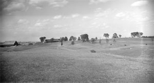
| Great Blue Hill |
|
| Gun Hill |
| • |
Google Maps | Google Earth - Google |
| • |
"...It is supposed to owe its name to an incident of the Indian wars. The story goes that on one occasion a heavy gun, which a detachment of soldiers were drawing over the hill, got so hopelessly stuck in the mud here that it had to be abandoned for a night with a guard to prevent its capture by the enemy; and thereafter the Miltonians called the place Gun Hill...", Bacon, 1897 - Internet Archive |
|
| Hancock Hill |
|
| Hemenway Hill |
|
| Houghton Hill |
|
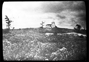
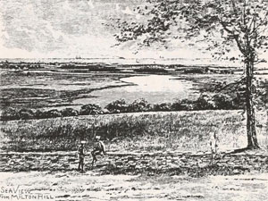
| Milton Hill |
| • |
USGS identified - MassMapper MassGIS |
| • |
Google Maps | Google Earth - Google |
| • |
"...The head-quarters of his predecessor, Nanepashemet, was supposed to have been on the south side of the river, near the head of tide-water, most likely on that bold outlook, Milton Hill...", Teele, pg. 2, 1887 - Internet Archive |
| • |
"...[Thomas Hutchinson] built a country house on Adams Street at the top
of MiltonHill in 1743, and had become greatly attached to the town. When
his Boston house was sacked and gutted by the mob one night in the sum-
mer of 1765, he moved out to Milton, and continued to live here most of the
time for as long as he remained in this country...", Hamilton, pg. 42 , 1957 - HathiTrust |
| • |
"...Milton Hill occupies the north-eastern portion of the town. Rising by a gradual ascent from the southerly shore of the
Neponset river, and from the marsh adjoining the river, it reaches the height of one hundred and thirty-eight feet above mean tide...", Teele, pg. 102, 1887 - Internet Archive |
| • |
"...The first Forbes house on Milton Hill, however, was built just before 1831 as a summer place, but the family could hardly be considered summer residents, as their roots in Milton even at that time went back for seventy years or more...", Hamilton, pg. 42 , 1957 - HathiTrust |
| • |
Milton Hill Historic District - Massachusetts Cultural Resource Information System (MACRIS) |
| • |
"...This field is to be forever open, by the gift of John Murray Forbes, to
all who stand on Unquity (Milton) Hill...", Abbott, pg. 298 , 1903 - HathiTrust |
| • |
Milton Hill - USGS Geographic Names Information System |
|
| Mingo Hill |
| • |
Google Maps | Google Earth - Google |
| • |
"...Not far west of the Kendall house, situated on a rise of land now owned by Mr. H. A. Whitney, on the south side of the avenue, was a small house long occupied by Mingo, an indian or negro, who lived to a great age. The hill is now called 'Mingo Hill'...", Teele, pg. 168, 1887 - Internet Archive |
|
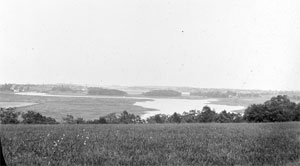
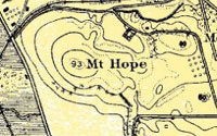
| Mount Hope |
|
| Morton Hill |
| • |
Google Maps | Google Earth - Google |
| • |
"...Mrs. Stafford was a daughter of Joseph Morton, for whom Morton Hill was named...", Sammarco, 2010 - Google ebook preview |
|
| Wadsworth Hill |
| • |
Google Maps | Google Earth - Google |
| • |
"...In the year 1656 Capt. Samuel Wadsworth moved to Milton and took possession of one hundred acres of land on Wadsworth Hill, where Capt. E. D. Wadsworth now resides, which was then a wilderness without roads, and a mile from any other inhabitant...", Teele, pg. 153, 1887 - Internet Archive |
| • |
"...Captain Wadsworth and his men were ambushed by about five hundred Indians, with the usual war-whoops and savage attack. After a desperate struggle for five hours Wadsworth had lost five men : the Indians had lost more than a hundred. But as night approached the Indians set
fire to the dry grass, the smoke blinding the colonists, and they were obliged to abandon their sheltered position and were literally cut to pieces. Captain Wadsworth. covered with wounds, it is said, was one of the last to fall. Thirty men, including Captain Brocklebank, Captain Wadsworth and two other officers were slain, and were buried on one grave...", Historic Homes and Institutions and Genealogical and Personal Memoirs of Worcester County, Massachusetts, Volume 1, pg. 129, Ellery B. Crane 1907 - Internet Archive |
|
| Wigwam Hill |
| • |
Google Maps | Google Earth - Google |
| • |
"...Wigwam Hill is the first Hill south-west of Academy Hill, extending from the pound to Pine-tree brook...", Teele, pg. 206 , 1887 - Internet Archive |
| • |
Indians of Milton, "...further evidence that the area had been occupied and even populated by Native Americans, the nearby hill on which the new high school and the Indian Cliffs homes now stand was once called 'Wigwam Hill' ...", William P. Fall, 2007 - Milton Historical Society |
|
| Wildcat Notch |
|
| Wolcott Hill |
|
|
|
 |
|
 |
|
 |
|
 |
|
 |
|
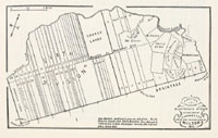
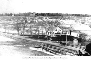
| Cary Hill |
 |
|
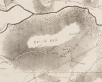
| Brush Hill |
 |
|
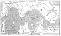
| Great Blue Hill |
 |
|
 |
|
| Hancock Hill |
 |
|
| Milton Hill |
 |
|
 |
|
| Mount Hope |
 |
|
 |
|
|
|
| More about Milton's USGS-listed hills |
|
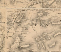
The border between Canton and Milton runs directly over the top of the tallest hill in the Boston Basin, the USGS-listed Great Blue Hill (626 ft.)1 For this survey the hill is listed under Milton because all of Milton lies within the Boston basin, while most of Canton does not. But, Canton does have the nearby USGS-listed Little Blue Hill (315 ft.). Milton has ten USGS-listed hills, seven are in the Blue Hills Reservation. When Europeans first settled on land south of the Neponset river in the Dorchester land grant they used the Native American term Unquity (Unquety), or the longer Unquity-Quisset, for the area. Multiple translations of the terms exist, with the most common being the place on a tidal estuary where salt water meets fresh water, and possibly with a waterfall there. When the area became a separate town in 1662 it took the name Milton, likely following the tradition of selecting a town in England where early settlers had lived before immigrating. |
| The three Milton hills that are not in the Blue Hills Reservation are, Academy Hill (131 ft.), Brush Hill (75 ft.), and Milton Hill (112 ft.). Academy Hill wouldn’t become Academy Hill until 1796 when Milton Academy was built on its summit. Brush Hill got its name much earlier. One of those settlers from Milton, England was Robert Tucker.2 He is recorded as purchasing land on “Bresh Hill” in 1663. The tradition in one town history book is that the hill got its name because a great forest fire swept over the hill leaving an area where a thick growth of bushes sprang up. It is also possible that hill, located on a path Native Americans regularly traveled from the Neponset River to the Blue Hills, was land they burned twice a year to keep clear or shrubbery and small trees. Decimation of the Native America population shortly before settlers arrived could have stopped their normal upkeep.3 Milton Hill has been an important location throughout the history of the town, and earlier. The hill overlooks the Neponset River estuary and is next to falls that were a favored fishing spot of the Native Americans. It is recorded as the seat of Nanepashemet, sachem of the Neponset tribe. |
| None of the three Milton hills not in the Blue Hills Reservation - Academy Hill, Brush Hill, and Milton Hill - carry a family name, but through the 1700s there are interesting links between the families living on them, many with a Scottish connection. |
| Oddly, for a story about families and their descendants, the first connection to a hill in Milton is from a man who was married twice but with no children, and a woman who was married three times and also never had children.4 James Smith (1689-1769, born in Scotland) was a sugar-maker with a refinery and a home in Boston. His business, in operation since 1729, had made him one of the wealthiest men in the city. In 1734, he bought 300 acres of land and built a mansion on top of Brush Hill in Milton. An interesting anecdote is thar it was Smith who first brought European Dutch elm trees to America. He planted them on his Brush Hill estate. While this sounds like the origins of Dutch elm disease, it’s not the case. The name "Dutch elm disease" refers to its identification in 1921 by Dutch plant pathologists. The hybrid “Dutch elm” trees that Smith imported were more resistant to the disease than North American varieties.5 |
|
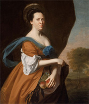
While the families living on these three Milton hills in the 1700s would have descendants that became magnates of commerce and industry, judges, governors, senators, vice presidents, even a president, it’s James Smith’s second wife, Elizabeth (Murray) Campbell, Smith, Inman (1726-1785),6 who has one of the more interesting stories as she overcame social barriers and persevered during the tumultuous times before and after the revolutionary war. Born in Scotland), she first followed her brother James Murray (1713-1781) and immigrated to North Carolina working as his housekeeper. In 1749 she was in Boston and, with help from her brother, set up a shop for English millinery goods and needle work. In 1755 she married Thomas Campbell, a Scottish merchant and ship captain, but he died in a measles epidemic three years later. In colonial America, being a “she-merchant” was an acceptable way for widowed or single women to support themselves. If Elizabeth remarried, coverture for a woman was the legal doctrine of the time that held that a woman’s legal rights and wealth were subsumed by her husband upon marriage. A shrewd business woman, when she married her second husband, James Smith, a wealthy sugar-baker, in 1760, her new husband signed a prenuptial agreement that allowed Elizabeth to keep all her own money that she had earned as a shopkeeper and would be entitled to one-third of his considerable estate if he died before her. She was 33 years old, he was 72. |
| James and Elizabeth retired to their Brush Hill estate, though Elizabeth continued to teach women the ways of shop keeping and financially helped her brother’s two children, Dorothy (1745-1837) and Elizabeth (1756-1837), along with other nieces, nephews and local up-and-coming women shopkeepers. Her brother James’ wife had died in North Carolina, and his business and political ambitions there were not successful. He was now in Boston running James Smith’s sugar business and living in his house in Boston. Political tensions were rising in Boston, 1764 was the Sugar Act, 1765 the Stamp Act, and in 1768 British troops arrived in Boston. When the town refused to offer housing for the troops, it was James Murray who let them stay in the Smith sugar factory warehouse, and it was troops from that warehouse that fired at the crowd in the Boston Massacre in 1770. James Smith had died in 1769 leaving Elizabeth a widow again, albeit a wealthy one. |
| After a year to recuperate in Scotland, Elizabeth was back in Boston in 1770, and in a short time married Ralph Inman (1713–1788), whom she had known since her early days as a merchant and shopkeeper. It was his second marriage. At the outbreak of war in 1775, Elizabeth was in a precarious position. Her close business dealings with England made her suspect of being a loyalist. Her brother was a loyalist and would flee to Halifax. Her husband, also a loyalist, took refuge in Boston protected by British troops. It was Elizabeth who stayed at the Inman estate in Cambridge. Showing great political savvy, she had earlier asked her friend patriot general Israel Putnam for protection. He assigned his son, Daniel Putnam, to guard her. On the night after the Battle of Bunker hill, he would escort Elizabeth to her family estate on Brush Hill, learning on the way that his father was safe. While most loyalists had their properties confiscated during the revolutionary war, Elizabeth, possibly foreseeing this potential problem earlier, had asked James Smith in his will to put the Milton estate in the names of her brother’s two daughters. This would keep the property in family hands. The Inman house in Cambridge was immediately taken over by patriot troops and used as general Putnam’s headquarters. |
| After the war, Ralph, who had fled to England, would pledge loyalty to the new country and receive permission to return and try to reclaim his property. Elizabeth, despite being denounced in the press and accused as a spy, would weather the challenges and stay in New England. Accounts vary on how much the couple reconciled after the war. But, Elizabeth, who had a prenuptial agreement with Ralph, just before her death in 1785 would rewrite her will and distribute most her property and wealth to her nieces and friends, and very little to her husband. She was buried next to her second husband, James Smith. |
| Elizabeth’s two nieces, Dorothy (Dolly) and Elizabeth (Betsy), her brother James’ two daughters would both marry men who would have links to Milton’s two other USGS-listed hills not in the Blue Hills Reservation. Dolly in 1769 married John Forbes (1740-1783),7 a Scotsman, and an Anglican minister posted to St. Augustine, Fl., then under British rule. They would have three sons, but it proved to be a difficult marriage. She couldn’t tolerate the climate in Florida, so returned to Boston with their second son, and pregnant with their third. She would never see her husband or eldest son again, as Loyalists, they both moved to England. Her youngest son, Ralph Bennet Forbes (1773-1824), married Margaret Perkins (1773-1856). She was the daughter of Thomas H. Perkins (1764-1854), a Boston merchant who would become wealthy in the China trade, including Turkish opium. He would be responsible for selecting the name of Belmont, Mass. Ralph would die young, at age 40. The three sons, now all involved in the China trade with the uncle, would raise the funds needed to buy land and build an estate for their widowed mother on Milton hill. |
|
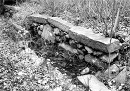
Another prominent pre-revolutionary war figure who is connected to a hill in Milton is Thomas Hutchinson (1711-1780).8 A successful merchant and politician, he was lieutenant governor, and then governor from 1758 to 1774. In 1740 he purchased much Milton hill (then called Unquity hill) and built a summer house there in 1743. A fifth generation American, and descendant of controversial spiritual leader Anne Hutchinson, he passionately supported the new colony but was put into an untenable situation by passage of the 1765 Tax Act by the British government. He was governor during the Boston Tea Party and the Boston Massacre. Ultimately his house in Boston would be ransacked, and then shortly after he and family fled in exile, his house in Milton would be looted and confiscated. One remnant of his estate that remains has the unique name, a ha-ha, a sunken wall which permits unblocked views, while still serving functions of a wall such as delineating a border and preventing livestock from crossing. |
| Elizabeth (Betsy) Murray would marry Edward Hutchinson Robbins (1758-1829), a cousin of colonial governor Thomas Hutchinson. He would be elected speaker of the Massachusetts House of Representatives, became lieutenant governor of Massachusetts, and appointed a judge. He also provided funds for the first Milton Academy in 1798, on what would become known as Academy Hill. |
|
|
| Milton Maps |
| • |
Milton - Google Maps, Terrain |
| • |
Milton - MassMapper MassGIS |
| • |
Milton - USGS - The National Map |
| • |
Blue Hills Quadrangle - 2018 (60 MB PDF) - USGS Topo Download |
| • |
Boston South Quadrangle - 2018 (60 MB PDF) - USGS Topo Download |
| • |
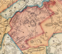
Map of Norfolk County, Massachusetts, Henry F. Walling, 1853 - Library of Congress |
| • |
Map of Norfolk County, Massachusetts, Smith & Bumstead, 1858 - Library of Congress |
| • |
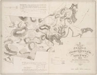
Atlas of Milton, Massachusetts, Geo. H. Walker, 1896 - State Library of Massachusetts |
| • |
Atlas of Milton, Massachusetts, Geo. H. Walker, 1905 - State Library of Massachusetts |
| • |
A Map of the Towns of Dorchester and Milton, Edmund J. Baker, 1831 - Norman B. Leventhal Map Center, Boston Public Library |
| • |
Blue Hills Reservation Trail Map (PDF) - State of Massachusetts |
| • |
Topographical map of Blue Hills Reservation , Massachusetts. Metropolitan Park Commission, 1895 - Norman B. Leventhal Map Center, Boston Public Library |
| • |
The Blue Hills, E.G. Chamberlain, Appalachian Mountain Club, Appalachia, Vol. 3, pg. 122, 1882 - HathiTrust |
| • |
Guide to View from Great Blue Hill, Milton, E.G. Chamberlain, 1904 - Collection of Historical Scientific Instruments, Harvard University |
| • |
Blue Hills Reservation, Massachusetts. Metropolitan Park Commission, 1905 - Norman B. Leventhal Map Center, Boston Public Library |
| • |
Job #1504, Blue Hills Reservation - Olmstead Archives, NHS, NPS |
| • |
Flora of the Blue Hills Reservation, Metropolitan Park Commission, 1896 - WikiMedia Commons |
| • |
Historic Writing and Maps - Friends of the Blue Hills |
|
|
| Milton Sources |
| • |
The History of Milton, Mass., 1640 to 1877, Albert K. Teele, 1887 - Internet Archive |
| • |
The Milton Catechism; An Outline of the History of Milton, Massachusetts, Milton Historical Society, 1910 - Internet Archive |
| • |
A History of Milton, Edward P. Hamilton, 1957 - HathiTrust |
| • |
Milton, History of Norfolk County, Massachusetts, with Biographical Sketches of Many of its Pioneers and Prominent Men, Duane Hurd, 1884 - Internet Archive |
| • |
Milton, History of Norfolk County, Massachusetts, 1622-1918, Louis A. Cook, Vol. 1, 1918 - Internet Archive |
| • |
Milton, Walks and rides in the country round about Boston, pg. 320, Edwin M. Bacon, 1897 - Internet Archive |
| • |
A Brief History of Milton, Brian Doherty - Town of Milton 350th Anniversary |
| • |
Milton Historical Society |
| • |
Milton History - Milton Historical Society |
| • |
Milton (Unquity-Quisset), 1633-1662, Old Paths and Legends of New England, pg. 298, Katharine M. Abbott, 1903 - HathiTrust |
| • |
Source Material for Teaching the History of Milton, Massachusetts (PDF), Irma Jane Wren, 1950 - OpenBU, Boston University |
| • |
Tour 19: From Boston to Bounre, Massachusetts: A Guide to Its Places and People, pg. 586, Federal Writers' Project, 1937 - Google ebook preview |
| • |
History of the Town of Dorchester, Massachusetts, Ebenezer Clapp, 1859 - Internet Archive |
| • |
Milton, MHC Reconnaissance Survey Town Report (PDF), 1981 - Massachusetts Historical Commission |
| • |
Milton Architectuew: Images of Amercia, Anthony M. Sammarco, Paul Buchanan, 2000 - Google ebook preview |
| • |
Milton: A Compendium, Anthony M. Sammarco, 2010 - Google ebook preview |
|
|
| Footnotes |
| 1 |
The USGS record for Great Blue Hill lists the elevation as 594 ft. Topographic lines of the USGS topographic maps of the hill show it over 620 ft. - USGS |
| 2 |
Robert Tucker House - Massachusetts Cultural Resource Information System (MACRIS) |
| 3 |
The Converging Cultures of the Neponset River Estuary, Richard Heath, 1996 - Dorchester Atheneum |
| 4 |
Letters of James Murray, Loyalist, Nina M. Tiffany, Susan I. Lesley, 1901 - Internet Archive |
|
The Loyalists of Massachusetts, James H. Stark, 1907 - Google ebook |
| 5 |
Teele, pg. 615 - Internet Archive |
|
Bulletin of Popular Information (PDF), 1918 - Arnold Arboretun |
| 6 |
The Elizabeth Murray Project - California State University, Long Beach |
|
Elizabeth Murray: A Woman's Pursuit of Independence in Eighteenth-Century, Patricia Cleary, 2000 - Google ebook preview |
|
Merchant of the She, Elizabeth Murray, pg. 33, Wild Women of Boston: Mettle and Moxie in the Hub, Dina Vargo - Google ebook preview |
|
Murray-Robbins Family Papers - Massachusetts Historical Society |
|
Woman Shopkeeper in 1769 Boston, Mrs. James Smith (Elizabeth Murray) - 18c American Women |
|
The Ice King, the Castle Captain, and the She-Merchant - Next Exit History |
|
Women's Concerns: Twelve Women Entrepreneurs of the Eighteenth and Nineteenth Centuries, Jill C. Jepson, 2009 - Google ebook preview |
|
Elizabeth Murray - History of American Women |
|
Inman House, pg. 171, An Historic Guide to Cambridge, 1907 - Google ebook |
|
Inman Square - Bouseblog |
| 7 |
Forbes House Museum |
|
Forbes Family. Forbes Family Business Records, 1658-1968: A Finding Aid - Havard University Library |
|
Capt. Robert Bennett House - Massachusetts Cultural Resource Information System (MACRIS) |
| 8 |
The Life and Times of Thomas Hutchinson, Royal Governor of Massachusetts |
|
The Governors of Milton, Anthony M. Sammarco, 2010 - Milton Historical Society |
|
Gov. Hutchinson's Field - Massachusetts Cultural Resource Information System (MACRIS) |
|
Gov. Hutchinson's Ha-Ha - Massachusetts Cultural Resource Information System (MACRIS) |
|
Governor Thomas Hutchinson Milton House - Unquety, Governor’s Houses and State Houses of British Colonial America, 1607–1783, pg. 121, Hoke P. Kimball, Bruce Henson, 2017 - Google ebook preview |
|
Governor Hutchinson's Field - The Trustees of Reservations |
|
|