| Hills of Burlington, Mass. |
| | Hills | More about Burlington' USGS-listed hills | Maps | Sources | |
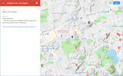
| Babylon Hill |
| • |
USGS identified (Historical) - MassMapper MassGIS |
| • |
Google Maps | Google Earth - Google |
| • |
A Vision for Mary Cummigs Park (PDF), "...The Cummings Farm at Babylon Hill was once one of the most productive farms of the area..." - The Friends of Mary Cummings Park |
| • |
"... Cambridge Street, into which we turn, at the left, from Bedford Street, continues through pleasant parts, growing more rural as we advance. Off to the right, as we enter it, is Babylon Hill...." - Bacon, pg. 135 - Internet Archive |
| • |
Mary Cummings Park - Woburn Residents' Environmental Network |
| • |
John Cummings, Treasurer of the Institute 1872-1889, The Technology Review Vol. 1, pg.184, Massachusetts Instute of Technology,1899 - HathiTrust |
| • |
John Cummings, Samuel A. Eliot, Biographical history of Massachusetts, 1914 - Google ebook |
| • |
The Portrait of John Cummings, The Technology Review, Vol. 42, pg. 291, Massachusetts Instute of Technology,1920 - Internet Archive |
| • |
The Cummings Memorial, a Genealogical History of the Descendants of Isaac Cummings, George Mooar, 1903 - Internet Archive |
| • |
Cummings Genealogy: Isaac Cummings, 1601-1677 of Ipswich in 1638 and some of his Descendants, 1893 - Internet Archive |
| • |
David Cummings Tannery Building, "...The tarining industry was one of the most significant Colonial industries for both Wobum and Burlington, and the Cummings family remained one of Wobum's leading tanners into the 20th century..." - Massachusetts Historical Commission Information System (MACRIS) |
| • |
Babylon Hill (historical) - USGS Geographic Names Information System |
|
| Winn Hill |
| • |
USGS identified - MassMapper MassGIS |
| • |
Google Maps | Google Earth - Google |
| • |
Winn Memorial Library,"...The first born child recorded in the town was Increase Winn, born, December 5, 1641.. Many of the family are listed as holding offices of a civil and military nature in the town and no other family can be said to have done more for the welfare of the town than Jonathan Bowers Winn and his son
Charles Bowers Winn..." - Massachusetts Historical Commission Information System (MACRIS) |
| • |
Wynn, John - Winn, Timothy House, "...The John Wynn [or Winn; the name was spelled both ways] House is said by Burlington historian John E. Fogelberg to have been constructed upon the site of the 1640 log cabin (or timber framed structure?) of Edward Winn, who was one of the pioneer settlers of both Woburn and Burlington...." - Massachusetts Historical Commission Information System (MACRIS) |
| • |
"...No name is better known in Middlesex county, Massachusetts, or has been longer before the public, than that of Winn.....", Cutter, pg. 1139, Vol. 3, 1908 - Internet Archive |
| • |
"...The Winn family were some of the earliest settlers of the Woburn-Burlington area. Edward Winn began the family line in America when he landed in 1640 and helped establish the town of Woburn in 1642...", Costa, 2001 - Google ebook preview |
| • |
"...Winn Hill. This station is a temporary peg situated in the eastern part of Burlington, about 575 feet northerly from the junction of Lowell and Wyman streets in Woburn...", Atlas of the Boundries of the Town of Woburn, Sheet 4 (PDF), 1899 - Topographical Survey Commission Commonwealth of Massachusetts |
| • |
Edward Winn, "...He settled first in Charlestown, Massachusetts, and was one of the commissioners for founding the contemplated town of Woburn and met with them 18 Dec 1640..." - Miner Descent |
| • |
Winn Hill- USGS Geographic Names Information System |
| • |
"...and Mt. Plainum (so named from its elevation above the plain), rising in a fine slope, on one side. This mount
was early mined for minerals, but without profitable result, and sometime went by the name of Copper Hill...", Bacon, pg. 133, 1897 - Internet Archive |
| • |
"...Burlington Street was the way to Mount Playnum. The new bridge leading to Mount Playnum in 1648 was probably on this street...", List of Accepted Streets in Woburn, Mass. 1898 - City of Woburn |
|
|
|
|
|
| More about Burlington' USGS-listed hills |
|
Burlington became a separate town in 1799 after being part of Woburn since it separated from Charlestown in 1642. The town has six USGS listed hills, two are in the Boston Basin Hills survey area; Babylon Hill\ and Winn Hill. Bannon Hill,Greenleaf Hill,Peach Orchard Hill are outside of Route 128 so are not included in this survey. Babylon Hill (239 ft.) is the name Mary Cummings (1839-1927) used in her 1925 will to describe the land in Burlington and Woburn that she was giving to the City of Boston for use as a park. The hill is identified in the USGS topographic 1893,1 and in the 1922 O.W. Walker Atlas of Massachusetts2. But in the 1946 USGS map, the hill is no longer identified. The Cummings family in the Woburn/Burlington area date back to 1756 when David Cummings built a tannery there. The business prospered and future generations would own so much land in the town that a neighborhood would be called “Cummingsville.” John Cummings (1812-1898), the great-grandson of David Cummings, and the husband of Mary Cummings, became one of the leading tanners in Massachusetts. He also was president of Shawmut Bank for 30 years, served in both the Massachusetts House of Representatives and Senate, and was the second treasurer at the Massachusetts Institute of Technology, helping the institution out of a financial crisis by personally backing its debt. |
| Winn Hill (259 ft.)is named for the Wynn family who were some of the earliest settler of the Woburn-Burlington area. Edward Winn began the family line in America when he landed in 1640 and helped establish the town of Woburn in 1642. |
|
|
| Burlington Maps |
| • |
Burlington - Google Maps, Terrain |
| • |
Burlington - MassMapper MassGIS |
| • |
Burlington - USGS - The National Map |
| • |
Lexington Quadrangle - 2018 (60 MB PDF) - USGS Topo Download |
| • |
Wilmington Quadrangle 2018 (60 MB PDF) - USGS Topo Download |
| • |
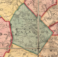
Plate No. 4, Atlas of Massachusetts, O.W. Walker, 1922 - State Library of Massachusetts |
| • |
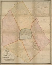
Burlington, Atlas of Middlesex County, Volume 2, published by Geo. H. Walker & Co., 1906 - State Library of Massachusetts |
| • |
Map of Middlesex County, Massachusetts, Henry F. Walling, 1856 - Norman B. Leventhal Map Center |
| • |
Map of Middlesex County, Massachusetts, Henry F. Walling, 1856 - Library of Congress |
|
|
| Burlington Sources |
| • |
Burlington, History of Middlesex County, Massachusetts, with Biographical Sketches of Many of its Pioneers and Prominent Men, Duane Hurd, Vol. 1, 1890 - Internet Archive |
| • |
Burlington, History of Middlesex County, Massachusetts: Containing Carefully Prepared Histories of Every City and Town in the County, Samuel A. Drake, Vol. 1, 1880 - Internet Archive |
| • |
The History of Woburn, Middlesex County, Mass., from the Grant of Its Territory to Charlestown, in 1640, to the Year 1860, Samuel Sewall, 1860 - Internet Archive |
| • |
Walks and Rides in the Country Round about Boston, Edwin M. Bacon, 1897 - Internet Archive |
| • |
Historic Homes and Places and Genealogical and Personal Memoirs Relating to the Families of Middlesex County, Massachusetts, Volumes 1-4, William R. Cutter, 1908 - Internet Archive |
| • |
Burlington Historical Society presents: Memories of Mary Cummings Park & Land Locked Forest - Burlington Cable Access Television (BCAT) |
| • |
Burlington: Images of America, Robert J. Costa, 2001 - Google ebook preview |
|
|
| Footnotes |
| 1 |
Boston, 1893, USGS Historical Topographic Map Explorer - USGS |
| 2 |
Plate No. 4, Atlas of Massachusetts, O.W. Walker, 1922 - State Library of Massachusetts |
|
|