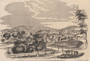
| South Bostom was originally considered a peninsula that connected the Dorchester settlement with Dorchester Heights. Landfill expanded the landmass of South Boston taking over an area of what was once the harbor that extends all the way to Fort Independence on what is now called Castle Island. |
|
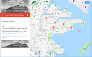
| Hills of South Boston - Boston, Mass. |
| Bush Tree Hill |
| • |
Google Maps | Google Earth - Google |
| • |
"...What is now Independence Square was then known as Bush Tree Hill, but it was much larger in extent at that time...", Toomey, Rankin, pg. 23 , 1901 - Internet Archive |
| • |
"...Broadway Hill, known in its early history as "Bush Tree Hill," is next to Telegraph Hill in height. This elevation is bounded by L, East Second, O, and East Fourth streets, and a part of its surface is laid out as a park, known as Independence Square...", Toomey, Rankin, pg. 286 , 1901 - Internet Archive |
| • |
Improvements to Medal of Honor Park, "...In 1897, the park historically known as Independence Square was set aside by the City of Boston for public open space. In 1981, the first memorial honoring Vietnam Veterans in the nation was constructed at Medal of Honor Park..." - City of Boston |
|
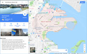
| Castle Island |
| • |
USGS identified - MassMapper MassGIS |
| • |
Google Maps | Google Earth - Google |
| • |
Castle Island (Massachusetts): "...First named Castle William by the English, who were fighting the French for control over North America...The fort was renamed Fort Independence in 1797 and is one of the oldest fortified sites in British North America...Castle Island was originally some distance offshore, but land reclamation for expansion of port facilities has extended the mainland towards it, and it is now connected to the mainland by pedestrian and vehicle causeways..." - Wikipedia |
| • |
Fort Independence (Massachusetts): "...The site of Fort Independence has been occupied by various fortifications since 1634. The first fort to be constructed on Castle Island resulted from a visit by Governor John Winthrop..." - Wikipedia |
| • |
Fort Independence: "...Located in the main shipping channel of Boston Harbor about two and one half miles from the city waterfront, Castle Island is the oldest fortified military site in British North America. The origin of the name, Castle Island, is unknown, but it was referred to in this manner before the first fort was built on the site in 1643..." - Massachusetts Historical Society |
| • |
"...Castle Island was named for a large castlelike fortification that had been built in the 17th century to defend to town of Boston...", Sammarco, 1900 - Internet Archive |
| • |
Castle Island (Cape) - USGS Geographic Names Information System |
|
| City Point |
|
| Dorchester Heights |
| • |
Google Maps | Google Earth - Google |
| • |
"...The Twin Hills on Dorchester Heights, known as the East and West Hills, no
longer can claim this distinction. Change upon change has been made, so that it would appear as if the present site of Dorchester Heights were one large eminence...", Gillespie, pg. 23 , 1900 - Internet Archive |
| • |
"...What is now South Boston has undergone many changes since it was Dorchester Neck, particularly in its topography. The two principal and most prominent hills, known in later years as Dorchester Heights, then were known as East and West Hills, although the easterly one, whereon the Perkins Institution now stands, was sometimes referred to as the Middle Hill and another, nearer to City Point, was the most easterly hill...", Toomey, Rankin, pg. 22, 1901 - Internet Archive |
| • |
"...The peninsula, which was about a mile's length and a half-mile's width, was shaped at a right angle, having a moderately wide, low lying, neck...At the eastern end of the point stood a group of three very steep hills that merged into what we might call conjoined summits, known by the separate names, Bush Tree Hill, Signal Tree Hill, and Foster Hill. Collectively, they were called Dorchester Heights, with two prominent crests, 'The Twin Hills.' ...", Bradford, pg. 28 (PDF) - Internet Archive |
| • |
Dorchester Heights, "...Dorchester Heights is the central area of South Boston. It is the highest area in the neighborhood and commands a view of both Boston Harbor and downtown..." - National Park Service |
| • |
Dorchester Heights, "...In 1898, the General Court of Massachusetts commissioned a monument to stand on the remaining hill of the Heights..." - National Park Service |
|
| Head Island |
|
| Leek Hill |
| • |
Google Maps | Google Earth - Google |
| • |
"...Captain Hopestill Foster, who died in 1676, owned a large lot of land, known as Leek hill, near the present junction of Second and Dorchester streets...", Gillespie, pg. 5, 1900 - Internet Archive |
| • |
"...Leek Hill at the north end of Dorchester street and Battery Hill at the Point have all passed away...", Gillespie, pg. 5, 1900 - Internet Archive |
| • |
"...Leek Hill was near the water's edge, at the northerly end of Dorchester Street. It was a small hill, yet was fortified during the Revolution. It was supposed to have been named after Thomas Lake, one of the first settlers of Dorchester, who once owned the land...", Toomey, Rankin, pg. 23, 1901 - Internet Archive |
|
| Mount Washington |
| • |
Google Maps | Google Earth - Google |
| • |
"...Both Telegraph Hill and Mt. Washington combined were known in years past as Dorchester Heights, and also as the "Twin Hills," but this title being vague, distinct titles were given each in order to distinguish them...", Toomey, Rankin, pg. 285, 1901 - Internet Archive |
|
| Nooks Hill |
| • |
Google Maps | Google Earth - Google |
| • |
"...When the British saw a battery on Hook's hill, their fear increased, and they poured their shot from the Green Store battery in it. On this hill four soldiers and a surgeon were killed...", Gillespie, pg. 14, 1900 - Internet Archive |
| • |
"...Westward from these twins, across a marshy level, stood a somewhat lower, steep, little elevation called Nooks Hill, directly facing Boston...The summits have all been cut down, and Nooks Hill leveled altogether to provide land fill...", Bradford, pg. 29 (PDF) - Internet Archive |
| • |
"...The smaller hill, the highest point of which was about where the Lawrence School is now situated, was Nook Hill, sometimes known as Foster's, Fox or Dorchester Hill. The Continental army commanded this hill during the Revolution just before the evacuation of Boston...", Toomey, Rankin, pg. 23, 1901 - Internet Archive |
|
| Telegraph Hill |
| • |
USGS identified - MassMapper MassGIS |
| • |
Google Maps | Google Earth - Google |
| • |
"...Both Telegraph Hill and Mt. Washington combined were known in years past as Dorchester Heights, and also as the "Twin Hills," but this title being vague, distinct titles were given each in order to distinguish them...", Toomey, Rankin, pg. 285, 1901 - Internet Archive |
| • |
Telegraph Hill - USGS Geographic Names Information System |
|
|
|
|
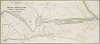
| South Boston Maps |
| • |
South Boston - Google Maps, Terrain |
| • |
South Boston - MassMapper MassGIS |
| • |
South Boston - USGS - The National Map |
| • |
Boston South Quadrangle - 2018 (60 MB PDF) - USGS Topo Download |
| • |
A Plan of Boston in New England with its Environs, Henry Pelham, 1777 - Norman B. Leventhal Map Center, Boston Public Library |
| • |
Boston with its Environs, Caleb P. Wayne, 1806 - Norman B. Leventhal Map Center, Boston Public Library |
| • |
Boston with its Environs, Richard R. Philips, 1806 - Norman B. Leventhal Map Center, Boston Public Library |
| • |
Boston Harbor, Massachusetts, U.S. Coast Survey Office, 1863 - Norman B. Leventhal Map Center, Boston Public Library |
| • |
Atlas of South Boston and Dorchester , G.M. Hopkins & Co., 1874 - State Library of Massachusetts |
| • |
Gen. Washington's Revolutionary Campaign War Map, A.O. Crane, 1875 - Norman B. Leventhal Map Center, Boston Public Library |
|
|
| South Boston Sources |
| • |
History of South Boston: Its Past and Present and Prospects for the Future, with Sketches of Prominent Men, John J. Toomey, Edward P.B. Rankin, 1901 - Internet Archive |
| • |
Illustrated history of South Boston, Charles B. Gillespie, 1900 - Internet Archive |
| • |
History of South Boston, formerly Dorchester Neck, now Ward XII of the City of Boston, Thomas C. Simonds, 1857 - Internet Archive |
| • |
Dorchester Heights: Prelude to Independence (PDF), Charles H. Bradford - Dorchester Atheneum |
| • |
South Boston, Boston 200 Neighborhood History Series, 1976 - Internet Archive |
| • |
South Boston: Then & Now, Mitchell Sammarco, 2006 - Google ebook preveiw |
|
|
|